
IMAGES TAKEN NEAR TO
Combe Royal Crescent, BATH, BA2 6EZ
Introduction
This page details the photographs taken nearby to Combe Royal Crescent, BA2 6EZ by members of the Geograph project.
The Geograph project started in 2005 with the aim of publishing, organising and preserving representative images for every square kilometre of Great Britain, Ireland and the Isle of Man.

There are currently over 7.5m images from over14,400 individuals and you can help contribute to the project by visiting https://www.geograph.org.uk
Image Map
Images are licensed for reuse under creativecommons.org/licenses/by-sa/2.0
Notes
- Clicking on the map will re-center to the selected point.
- The higher the marker number, the further away the image location is from the centre of the postcode.
Image Listing (62 Images Found)
Images are licensed for reuse under creativecommons.org/licenses/by-sa/2.0
Image
Details
Distance
1
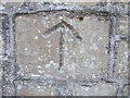
A pious mason?
One of a number of mason's marks on the walls of Bathwick Hill.
Image: © Neil Owen
Taken: 14 May 2020
0.01 miles
2
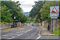
Bath : Bathwick Hill
Looking along Bathwick Hill.
Image: © Lewis Clarke
Taken: 6 Aug 2020
0.02 miles
3
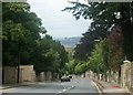
2008 : Bathwick Hill, Bath
Bathwick is at the bottom of the hill.
This is taken from the top, near the junction with North Road.
Some fine views for the walker on the way down but you may need to take the bus back up.
Image: © Maurice Pullin
Taken: 4 Aug 2008
0.05 miles
4
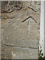
A mark and some numbers
More masons' marks on the wall at the top of Bathwick Hill.
Image: © Neil Owen
Taken: 14 May 2020
0.05 miles
5
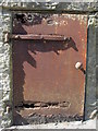
Rusting its hinges off
A rather rusty door that has seen better days. It lies in a wall of a residential property.
Image: © Neil Owen
Taken: 14 May 2020
0.06 miles
6
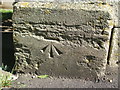
A benchmark at the top of Bathwick Hill
A fine cutmark, as listed in the Benchmark Database: https://www.bench-marks.org.uk/bm121058 , remains in very good condition despite its age of well over a century - a nod to the high quality of the Bath stone used here. See Image] for a wider view of the house entrance.
Image: © Neil Owen
Taken: 14 May 2020
0.07 miles
7
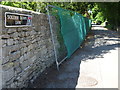
Soldier Down Lane
In its past, this lane was a long, straight route across Bathampton Down. It crossed the old Wansdyke before arriving at the ancient hill fort, but these days it is a lot shorter due to Bath University taking up a lot of the land here.
Image: © Neil Owen
Taken: 14 May 2020
0.07 miles
8
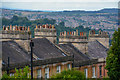
Bath : Rooftops
The rooftops overlooking Bath.
Image: © Lewis Clarke
Taken: 6 Aug 2020
0.07 miles
9
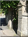
Benchmark by The Rectory
A benchmark lies on the entrance pier at the house at the junction of several roads at the top of Bathwick Hill. The inscription is The Rectory, although the residence is now known as Osbourne House. Previously it appears to have been called The Beeches. See Image] for a closer look at the cutmark.
Image: © Neil Owen
Taken: 14 May 2020
0.07 miles
10

Bathwick Hill junction with North Lane
Bathwick Hill runs from the junction with Pulteney Road in Bath city centre to the University of Bath on Claverton Down. The road has a steep gradient.
Image: © DS Pugh
Taken: 30 Mar 2026
0.07 miles