
IMAGES TAKEN NEAR TO
Fox Hill, BATH, BA2 5QW
Introduction
This page details the photographs taken nearby to Fox Hill, BA2 5QW by members of the Geograph project.
The Geograph project started in 2005 with the aim of publishing, organising and preserving representative images for every square kilometre of Great Britain, Ireland and the Isle of Man.

There are currently over 7.5m images from over14,400 individuals and you can help contribute to the project by visiting https://www.geograph.org.uk
Image Map
Images are licensed for reuse under creativecommons.org/licenses/by-sa/2.0
Notes
- Clicking on the map will re-center to the selected point.
- The higher the marker number, the further away the image location is from the centre of the postcode.
Image Listing (19 Images Found)
Images are licensed for reuse under creativecommons.org/licenses/by-sa/2.0
Image
Details
Distance
1
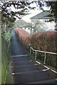
Path to Horsecombe Brow, Bath
If you lived in one of the houses in this photo, and wanted to get out onto the A3062 Bradford Road (from which this was taken) in an eastbound direction, it would be a tedious detour to have to walk all the way down the L-shaped cu;-de-sac and back up the road to this spot. You could also use this as a route onto the Shepherd's Path.
Image: © Derek Harper
Taken: 23 Feb 2016
0.04 miles
2

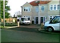
Bradford Road, Combe Down
Bradford-on-Avon that is, not the Yorkshire one.
Large houses built of the local stone, like almost everything here apart from the modern stuff.
Image: © Des Blenkinsopp
Taken: 22 Sep 2025
0.08 miles
4
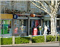
2008 : Combe Down Post Office and Store
The post office is at the centre of a small rank of shops set back from the main road.
Image: © Maurice Pullin
Taken: 14 Apr 2008
0.10 miles
5
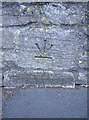
Inverted benchmark
It's not unheard of to find a cut benchmark with the arrows above the datum line, but the initial feeling about this example is that it is not level. Could it be that this mark has been repositioned in a rebuilt wall? If so, the reference is now unreliable. Maps of the 50-60's list a benchmark close by, so maybe it has indeed been 'recycled' as a feature.
See http://www.bench-marks.org.uk/bm39499 for the Benchmark Database, and Image] for the junction view.
Image: © Neil Owen
Taken: 10 Sep 2011
0.11 miles
6

Tilted benchmark near Horsecombe Brow
Once there appears to have been a benchmark close to this location; but the inverted and tilted aspect suggest that it has been lifted out of its original position and returned in an approximate place. See Image] for a closer view of the levelling.
Image: © Neil Owen
Taken: 10 Sep 2011
0.11 miles
7

2008 : Horsecombe Brow, Combe Down
Named after Horsecombe Vale, behind the houses. The shops in Image are on the other side of the main road and you can see Cley Hill, Image near Warminster in the distance.
Image: © Maurice Pullin
Taken: 14 Apr 2008
0.11 miles
8
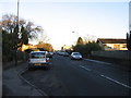
Bradford Road
This road runs between Combe Down and Fox Hill. The 'Bradford' is of course Bradford-on-Avon.
Image: © HelenK
Taken: 20 Jan 2011
0.13 miles

10

Autumn colour in a hedge, Combe Down
The setting sun catching this hedge and turning it deep red
Image: © David Smith
Taken: 26 Nov 2016
0.14 miles