
IMAGES TAKEN NEAR TO
Wratislaw Road, BATH, BA2 5FW
Introduction
This page details the photographs taken nearby to Wratislaw Road, BA2 5FW by members of the Geograph project.
The Geograph project started in 2005 with the aim of publishing, organising and preserving representative images for every square kilometre of Great Britain, Ireland and the Isle of Man.

There are currently over 7.5m images from over14,400 individuals and you can help contribute to the project by visiting https://www.geograph.org.uk
Image Map
Images are licensed for reuse under creativecommons.org/licenses/by-sa/2.0
Notes
- Clicking on the map will re-center to the selected point.
- The higher the marker number, the further away the image location is from the centre of the postcode.
Image Listing (20 Images Found)
Images are licensed for reuse under creativecommons.org/licenses/by-sa/2.0
Image
Details
Distance
1
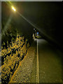
Bath : Combe Down Tunnel
This section of the Somerset and Dorset Railway, including the tunnels, is now incorporated into a shared-use walking and cycling path. Planning permission was approved in May 2008 and much of the funding came from a Sustrans Connect2 grant.
The fourth and final £100,000 tranche of council funding was made in the 2011/12 financial year; the tunnel was equipped with a cycle-friendly surface and LED lighting. The route was opened on 6 April 2013.
Image: © Lewis Clarke
Taken: 6 Aug 2020
0.04 miles
2
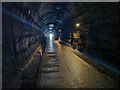
Bath : Combe Down Tunnel
On the footpath heading through Combe Down Tunnel. A cyclist approaches out of the darkness. Opened in 1874, this 1,829-yard (1,672 m) long disused railway tunnel was once the UK’s longest without intermediate ventilation. The tunnel now forms part of the £1.8 million Two Tunnels Greenway walking and cycling path opened on 6 April 2013 and is the longest cycling tunnel in Britain.
Image: © Lewis Clarke
Taken: 6 Aug 2020
0.06 miles
3
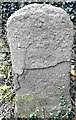
Old Boundary Marker on Pope's Lane, Bath
Parish Boundary Marker beside a public footpath called Pope's Lane which runs behind the houses on Hadley Road, Bath. Inscribed faintly P / L AND W. Similar boundary stones are dated 1894. On the former boundary of Lyncombe and Widcombe parish, which became part of Bath parish in 1900, and Monkton Combe parish
Milestone Society National ID: SO_WID09pb
Image: © A Ward
Taken: 1 Jan 2021
0.09 miles
4
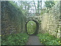
Bridge over footpath
This unusual bridge is found on a Combe Down to Widcombe footpath. To the left of the wall is the M.O.D. Foxhill, the fencing can be seen. To the right is housing. Atop the bridge appears to be part of a garden.
Image: © Graham D
Taken: 26 Apr 2008
0.12 miles
5
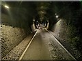
Bath : Combe Down Tunnel
This section of the Somerset and Dorset Railway, including the tunnels, is now incorporated into a shared-use walking and cycling path. Planning permission was approved in May 2008 and much of the funding came from a Sustrans Connect2 grant.
The fourth and final £100,000 tranche of council funding was made in the 2011/12 financial year; the tunnel was equipped with a cycle-friendly surface and LED lighting. The route was opened on 6 April 2013.
Image: © Lewis Clarke
Taken: 6 Aug 2020
0.12 miles
7

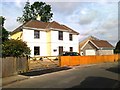
Bath : Combe Down Tunnel
This section of the Somerset and Dorset Railway, including the tunnels, is now incorporated into a shared-use walking and cycling path. Planning permission was approved in May 2008 and much of the funding came from a Sustrans Connect2 grant.
The fourth and final £100,000 tranche of council funding was made in the 2011/12 financial year; the tunnel was equipped with a cycle-friendly surface and LED lighting. The route was opened on 6 April 2013.
Image: © Lewis Clarke
Taken: 6 Aug 2020
0.15 miles
8

Priory Close
The slope leads up to Fox Hill where there was a former MOD site, though there was no access to it from this road. The site has become affordable housing.
Image: © Bill Boaden
Taken: 29 Jul 2016
0.15 miles
9

Cul-de-sac off Priory Close
The houses on this cul-de-sac still take the address of Priory Close. It is an established leafy residential road.
Image: © Bill Boaden
Taken: 29 Jul 2016
0.17 miles
10

Priory Close, Combe Down
Descending to the A3062 at the bottom, which leads into the centre of Bath.
Image: © Bill Boaden
Taken: 29 Jul 2016
0.17 miles