
IMAGES TAKEN NEAR TO
Holywell, YEOVIL, BA22 9NF
Introduction
This page details the photographs taken nearby to Holywell, BA22 9NF by members of the Geograph project.
The Geograph project started in 2005 with the aim of publishing, organising and preserving representative images for every square kilometre of Great Britain, Ireland and the Isle of Man.

There are currently over 7.5m images from over14,400 individuals and you can help contribute to the project by visiting https://www.geograph.org.uk
Image Map
Images are licensed for reuse under creativecommons.org/licenses/by-sa/2.0
Notes
- Clicking on the map will re-center to the selected point.
- The higher the marker number, the further away the image location is from the centre of the postcode.
Image Listing (26 Images Found)
Images are licensed for reuse under creativecommons.org/licenses/by-sa/2.0
Image
Details
Distance
1

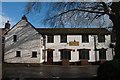
Holywell
From the gates on the right of Image], with cottages at the hamlet.
Image: © Derek Harper
Taken: 27 Apr 2019
0.01 miles
2
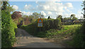
Lane approaching Holywell
Carrying the parish boundary between West Coker (right) and East Coker. There are glimpses of houses in the hamlet.
Image: © Derek Harper
Taken: 27 Apr 2019
0.03 miles
7
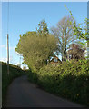
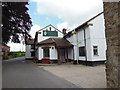
Lane from Holywell
Looking in the opposite direction from where Image] was taken; again, it carries the parish boundary between West Coker (left) and East Coker.
Image: © Derek Harper
Taken: 27 Apr 2019
0.06 miles
8
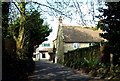
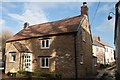
Thatched cottage - Holywell
The road leads from Hardington Moor through Holywell up to the A30 Crewkerne to Yeovil road. Behind the thatched cottage is The Foresters Arms local pub. There used to be a holy well in this hamlet hence the name.
Image: © Sarah Smith
Taken: 2 Apr 2009
0.07 miles
10
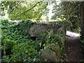
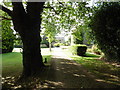
Bridge at the Mill at Holywell
This mill was one of three in the area which operated from the same stream. East Coker Mill and Paviott's Mill being the other two. Flax was grown in many areas until the late 1800s. Nearly every cottage had its looms for the weaving of Coker cloth.
Image: © Becky Williamson
Taken: 17 Sep 2014
0.10 miles