
IMAGES TAKEN NEAR TO
Dibbles Lane, YEOVIL, BA22 9BB
Introduction
This page details the photographs taken nearby to Dibbles Lane, BA22 9BB by members of the Geograph project.
The Geograph project started in 2005 with the aim of publishing, organising and preserving representative images for every square kilometre of Great Britain, Ireland and the Isle of Man.

There are currently over 7.5m images from over14,400 individuals and you can help contribute to the project by visiting https://www.geograph.org.uk
Image Map
Images are licensed for reuse under creativecommons.org/licenses/by-sa/2.0
Notes
- Clicking on the map will re-center to the selected point.
- The higher the marker number, the further away the image location is from the centre of the postcode.
Image Listing (65 Images Found)
Images are licensed for reuse under creativecommons.org/licenses/by-sa/2.0
Image
Details
Distance
1
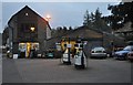
West Coker : The Garage
A garage on the High Street in West Coker.
Image: © Lewis Clarke
Taken: 16 Mar 2012
0.11 miles


4

The drive - Lanes West Coker
Looking down the drive from Lanes to the High Street in West Coker.
Lanes is a modern hotel set in an old traditional house and has a restaurant, brasserie and spa.
Image: © Sarah Smith
Taken: 24 Oct 2010
0.12 miles
5
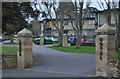
West Coker : Lanes Hotel Entrance
A former rectory has been extensively renovated to create a hotel and restaurant.
Image: © Lewis Clarke
Taken: 16 Mar 2012
0.12 miles
6
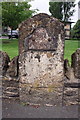
Old milestone in wall on NW side of High Street
The inscription on the metal plate is 'III YEOVIL'. The 1887 1:2500 map of Somerset shows the stone as 'Crewkerne 6 Yeovil 3'
Image: © Roger Templeman
Taken: 24 Sep 2013
0.12 miles
7

The Old Rectory - West Coker
An C18 building that was refaced in Ham stone ashlar early in the C19, and still in use as a Rectory. Grade II Listed.
Image: © Mike Searle
Taken: 24 Jul 2008
0.12 miles
8
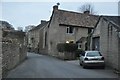
West Coker : Manor Street
Looking up Manor Street from the High Street.
Image: © Lewis Clarke
Taken: 16 Mar 2012
0.13 miles
9

Old Milestone by the A30, High Street, West Coker
Metal plate attached to stone post by the A30, in parish of West Coker (South Somerset District), High Street, in boundary wall of Lanes Hotel, fixed into stone wall beside pavement, on North-west side of road. Yeovil roll top iron plate, erected by the Yeovil Turnpike Trust in the 18th century.
Inscription reads:-
III
YEOVIL
Grade II Listed. List Entry Number:1057125
https://historicengland.org.uk/listing/the-list/list-entry/1057125
Milestone Society National ID: SO_YVCW03.
Image: © Milestone Society
Taken: 19 May 2018
0.13 miles
10
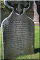
Memorial to PC William Penny - West Coker Churchyard
William Penny of the Somerset Constabulary is among the 4000 UK police officers who have lost their lives since the 1800s and before, in the line of duty. His grave is in West Coker churchyard, and his memorial records his death on 18 Jan. 1862 from injuries received in the execution of his duty. He was apparently beaten to death by three men he was attempting to arrest.
Image: © Mike Searle
Taken: 24 Jul 2008
0.13 miles