
IMAGES TAKEN NEAR TO
High Street, YEOVIL, BA22 9AQ
Introduction
This page details the photographs taken nearby to High Street, BA22 9AQ by members of the Geograph project.
The Geograph project started in 2005 with the aim of publishing, organising and preserving representative images for every square kilometre of Great Britain, Ireland and the Isle of Man.

There are currently over 7.5m images from over14,400 individuals and you can help contribute to the project by visiting https://www.geograph.org.uk
Image Map
Images are licensed for reuse under creativecommons.org/licenses/by-sa/2.0
Notes
- Clicking on the map will re-center to the selected point.
- The higher the marker number, the further away the image location is from the centre of the postcode.
Image Listing (51 Images Found)
Images are licensed for reuse under creativecommons.org/licenses/by-sa/2.0
Image
Details
Distance
1
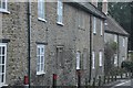
West Coker : Three & Five High Street
Two cottages, now one house. C18. Local store rubble with Ham stone dressings; Welsh slate roof over stone base course between coped gables, the West stepped and the East crowned with elaborate gabletted spire finial; brick end and intermediate chimney stacks. 2-storeys, 6-bays. Plain architraved and beaded mullioned surrounds to bays -3 lower and bay -4, of 3-lights below and 4- lights above, with blocked plain doorway now containing casement window between: elsewhere C20 casements with exposed timber lintels. East gable has painted arched window of 2-lights with C15 type tracery (possibly from Naish Priory, East Coker - QV). Entrance now at rear.
Image: © Lewis Clarke
Taken: 16 Mar 2012
0.03 miles

3
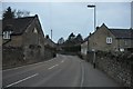
West Coker : High Street
High Street heading through West Coker village.
Image: © Lewis Clarke
Taken: 16 Mar 2012
0.04 miles
4
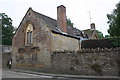
'The Hall', High Street
There is an OS benchmark Image on the far corner, road face, of the building, right of the road edge marker
Image: © Roger Templeman
Taken: 24 Sep 2013
0.04 miles
5
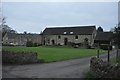
West Coker : Chicks Farmhouse
C17 with later modifications. Smooth rendered with incised false ashlar joints over Ham stone ashlar plinth, Ham stone dressings; Cornish slate roof between stepped coped gables, with double projecting gables to rear, East gable having gabletted finial; brick end and intermediate chimney stacks. 2-storeys, 4-bays. Ovolo mould mullioned windows, those to ground floor in stone with labels, 3-lights except bay-4 (2-lights); above in timber, all 2-lights; vertical iron bars to windows.
Image: © Lewis Clarke
Taken: 16 Mar 2012
0.05 miles
6

Benchmark on the Hall, High Street
Ordnance Survey cut mark benchmark described on the Bench Mark Database at http://www.bench-marks.org.uk/bm51630
Image: © Roger Templeman
Taken: 24 Sep 2013
0.05 miles
7
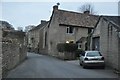
West Coker : Manor Street
Looking up Manor Street from the High Street.
Image: © Lewis Clarke
Taken: 16 Mar 2012
0.08 miles
8
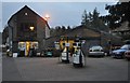
West Coker : The Garage
A garage on the High Street in West Coker.
Image: © Lewis Clarke
Taken: 16 Mar 2012
0.09 miles

10
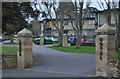
West Coker : Lanes Hotel Entrance
A former rectory has been extensively renovated to create a hotel and restaurant.
Image: © Lewis Clarke
Taken: 16 Mar 2012
0.13 miles