
IMAGES TAKEN NEAR TO
Lower Odcombe, YEOVIL, BA22 8TZ
Introduction
This page details the photographs taken nearby to BA22 8TZ by members of the Geograph project.
The Geograph project started in 2005 with the aim of publishing, organising and preserving representative images for every square kilometre of Great Britain, Ireland and the Isle of Man.

There are currently over 7.5m images from over14,400 individuals and you can help contribute to the project by visiting https://www.geograph.org.uk
Image Map
Images are licensed for reuse under creativecommons.org/licenses/by-sa/2.0
Notes
- Clicking on the map will re-center to the selected point.
- The higher the marker number, the further away the image location is from the centre of the postcode.
Image Listing (24 Images Found)
Images are licensed for reuse under creativecommons.org/licenses/by-sa/2.0
Image
Details
Distance
2
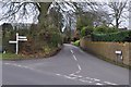
Odcombe : Lower Odcombe
A road called Lower Odcombe at the junction with Old Road.
Image: © Lewis Clarke
Taken: 16 Mar 2012
0.01 miles
3
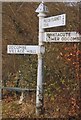
Old Direction Sign - Signpost by Old Road, Lower Odcombe, Odcombe Parish
Pyramid finial - 3 arms; Somerset pointing fingers by the UC road, in parish of Odcombe (South Somerset District), Lower Odcombe.
Surveyed
Milestone Society National ID: SO_ST5115
Image: © Milestone Society
Taken: Unknown
0.02 miles
5
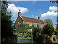
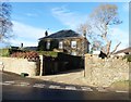
Bank Farmhouse - Lower Odcombe
Grade II listed former farmhouse dating from the C17, and partly reconstructed after a fire in C19.
Image: © Mike Searle
Taken: 24 May 2007
0.04 miles
6
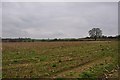
South Somerset : Grassy Field
A grassy field as seen from the public right of way heading through it.
Image: © Lewis Clarke
Taken: 16 Mar 2012
0.07 miles
7
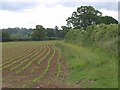
Field and boundary near Odcombe
A view from Old Road of a young crop, apparently maize.
Image: © Derek Harper
Taken: 9 Jun 2010
0.11 miles
8
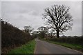
South Somerset : Country Road
A road which heads from Odcombe towards Yeovil.
Image: © Lewis Clarke
Taken: 16 Mar 2012
0.11 miles
9
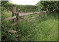
Stile and gate near Odcombe
The stile by which footpath Y 21/8 reaches Old Road. All rather charmingly overgrown, but not very convenient when you have to climb into the hedge to cross it.
Image: © Derek Harper
Taken: 9 Jun 2010
0.11 miles
10
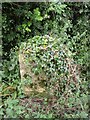
Remains of a milestone, near Odcombe
This milestone is supposed to have an Ordnance Survey benchmark on it, but it is on a busy road, and currently covered in ivy. I may return in the winter to nivestigate further, although initial investigation suggested the benchmark is very likely to have gone or at least be damaged.
Image: © Becky Williamson
Taken: 28 Jul 2015
0.14 miles