
IMAGES TAKEN NEAR TO
St. Margarets Road, YEOVIL, BA22 8PN
Introduction
This page details the photographs taken nearby to St. Margarets Road, BA22 8PN by members of the Geograph project.
The Geograph project started in 2005 with the aim of publishing, organising and preserving representative images for every square kilometre of Great Britain, Ireland and the Isle of Man.

There are currently over 7.5m images from over14,400 individuals and you can help contribute to the project by visiting https://www.geograph.org.uk
Image Map
Images are licensed for reuse under creativecommons.org/licenses/by-sa/2.0
Notes
- Clicking on the map will re-center to the selected point.
- The higher the marker number, the further away the image location is from the centre of the postcode.
Image Listing (120 Images Found)
Images are licensed for reuse under creativecommons.org/licenses/by-sa/2.0
Image
Details
Distance
1
![Tintinhull features [1]](https://s1.geograph.org.uk/geophotos/07/53/41/7534157_7f4c6b14_120x120.jpg)
Tintinhull features [1]
In St Margaret's Road is this K6 telephone box, designed in 1935 by Sir Giles Gilbert Scott. Listed, grade II, with details at: https://historicengland.org.uk/listing/the-list/list-entry/1264945
Tintinhull is a village in Somerset, some 4¼ miles northwest of Yeovil and about 17¼ miles southeast of Taunton. Originally an agricultural village with the surrounding landscape containing evidence of 2,000 years of farming, however, most working residents now commute. Mentioned in the Domesday Book, the village is home to the 17th century Tintinhull House and Gardens.
Image: © Michael Dibb
Taken: 19 May 2023
0.01 miles
2
![Tintinhull houses [10]](https://s3.geograph.org.uk/geophotos/07/53/42/7534211_6a73be90_120x120.jpg)
Tintinhull houses [10]
Francis's House, Vicarage Street, is a detached former farmhouse, dated 1609. Constructed, to an 'L' plan, of Ham stone ashlar under a plain tile roof with stone slate eaves courses. There are some 20th century rear extensions. Listed, grade II, with details at: https://historicengland.org.uk/listing/the-list/list-entry/1235518
Tintinhull is a village in Somerset, some 4¼ miles northwest of Yeovil and about 17¼ miles southeast of Taunton. Originally an agricultural village with the surrounding landscape containing evidence of 2,000 years of farming, however, most working residents now commute. Mentioned in the Domesday Book, the village is home to the 17th century Tintinhull House and Gardens.
Image: © Michael Dibb
Taken: 19 May 2023
0.03 miles

4

The Lamb Inn Tintinhull
The grid line runs down the main street, the pub and houses being on the opposite side of the line to the photographer.
Image: © Nigel Mykura
Taken: 21 Apr 2009
0.04 miles
5
![Tintinhull buildings [2]](https://s0.geograph.org.uk/geophotos/07/53/30/7533060_c12f2f9f_120x120.jpg)
Tintinhull buildings [2]
Adjacent to Lamb Farmhouse Image, in Farm Street, are these two barns. Built in the 18th or 19th century of coursed Ham stone rubble under double Roman tile roofs. Listed, grade II, with details at: https://historicengland.org.uk/listing/the-list/list-entry/1235189
Tintinhull is a village in Somerset, some 4¼ miles northwest of Yeovil and about 17¼ miles southeast of Taunton. Originally an agricultural village with the surrounding landscape containing evidence of 2,000 years of farming, however, most working residents now commute. Mentioned in the Domesday Book, the village is home to the 17th century Tintinhull House and Gardens.
Image: © Michael Dibb
Taken: 19 May 2023
0.04 miles
6
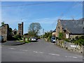
Church Street Tintinhull
This small street runs down the side of the church just off the village green
Image: © Nigel Mykura
Taken: 21 Apr 2009
0.04 miles
7
![Tintinhull features [2]](https://s2.geograph.org.uk/geophotos/07/53/41/7534162_8993019a_120x120.jpg)
Tintinhull features [2]
The boundary walls and entrance gateway to Tintinhull Court Image from St Margaret's were built in the 19th and 20th centuries. Constructed of squared Ham stone with ashlar dressings. There are two plain ashlar gate piers with 20th century wrought iron gates. Listed, grade II, with details at: https://historicengland.org.uk/listing/the-list/list-entry/1264992
Tintinhull is a village in Somerset, some 4¼ miles northwest of Yeovil and about 17¼ miles southeast of Taunton. Originally an agricultural village with the surrounding landscape containing evidence of 2,000 years of farming, however, most working residents now commute. Mentioned in the Domesday Book, the village is home to the 17th century Tintinhull House and Gardens.
Image: © Michael Dibb
Taken: 19 May 2023
0.05 miles
8

Imposing house at the centre of Tintinhull
Image: © Roger Cornfoot
Taken: 1 Nov 2017
0.05 miles
9
![Tintinhull houses [3]](https://s3.geograph.org.uk/geophotos/07/53/30/7533071_ff16970e_120x120.jpg)
Tintinhull houses [3]
The Dower House, 1 Farm Street, is a detached house built in the later 17th century and altered in the 20th century. Constructed of Ham stone ashlar under a plain tile roof. In the upper bay 4 is an oval window with carved stone wreath architrave, matching that at the nearby Tintinhull House Image There is an open stone porch, with Tuscan columns, possibly early 20th century. There is a one bay extension to the right. Listed, grade II*, with details at: https://historicengland.org.uk/listing/the-list/list-entry/1227288
Tintinhull is a village in Somerset, some 4¼ miles northwest of Yeovil and about 17¼ miles southeast of Taunton. Originally an agricultural village with the surrounding landscape containing evidence of 2,000 years of farming, however, most working residents now commute. Mentioned in the Domesday Book, the village is home to the 17th century Tintinhull House and Gardens.
Image: © Michael Dibb
Taken: 19 May 2023
0.05 miles
10
![Parish church [8]](https://s0.geograph.org.uk/geophotos/07/53/30/7533088_6777a444_120x120.jpg)
Parish church [8]
A railed memorial in the churchyard, which contains a number of listed memorials.
The Anglican parish church of St Margaret was built in the early 13th century, but parts of the east wall may be from an earlier building. The chancel arch was probably added when the church was remodelled in the 14th century. The south porch was built in the mid 15th century. The tower was not completed until 1516. The vestry was added in 1952. Constructed of Ham stone rubble, some cut and squared, with ashlar dressings under a stone slate roof on the chancel, and plain tiles on the nave. Fittings include a 13th century double piscina, a 15th century font and a 17th century pulpit. Listed, grade I, with details at: https://historicengland.org.uk/listing/the-list/list-entry/1235407
Tintinhull is a village in Somerset, some 4¼ miles northwest of Yeovil and about 17¼ miles southeast of Taunton. Originally an agricultural village with the surrounding landscape containing evidence of 2,000 years of farming, however, most working residents now commute. Mentioned in the Domesday Book, the village is home to the 17th century Tintinhull House and Gardens.
Image: © Michael Dibb
Taken: 19 May 2023
0.05 miles