1
Ilchester: The Market Cross
This column was built in 1795 at the north end of the town green on the site of an earlier market cross. Somerset County Council's Historic Environment Record describes it thus:
"Ham stone. Circular base with two chamfered offsets, set on circular step; square stepped plinth carrying simple Doric column with entablature moulding over, then square-plan block with sundials having sheet metal gnomons, and a ball finial with wrought-iron wind vane."
It is a Grade II listed structure and English Heritage Listed Building Number 263445. The top portion was blown over in a storm on 25 January 1991 and rebuilt the following year.
Image: © Nigel Cox
Taken: 12 May 2007
0.06 miles
2
Colour-washed cottages, High Street, Ilchester
No. 21 (to the left) from the early 19th Century is Grade-II listed: http://www.britishlistedbuildings.co.uk/en-263443-21-high-street-ilchester-somerset#.V5UN0CZTGmQ .
Image: © Bill Harrison
Taken: 3 Jul 2016
0.08 miles
3
High Street, Ilchester
Image: © Roger Cornfoot
Taken: 22 Nov 2017
0.08 miles
4
High Street, Ilchester
The colour-washed cottages in this attractive street date from around 1820.
Image: © Bill Harrison
Taken: 3 Jul 2016
0.08 miles
5
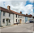
Ilchester houses [13]
Number 7 High Street, a cottage in a row was built in the early 19th century. Constructed of brick under a Welsh slate roof. The windows are horizontal sliding sashes. Number 7 is probably the best-preserved example of the first terrace of 'ribbon development' in Ilchester. Listed, grade II, with details at: https://historicengland.org.uk/listing/the-list/list-entry/1345744
Ilchester is a village in Somerset, situated astride the River Yeo or Ivel, some 4½ miles northwest of Yeovil and about 18 miles east of Taunton. Originally an important Roman town, Lindinis, on the Fosse Way and later a market town, in the medieval period Ilchester was the county town. It declined in size and importance and the last markets were held in 1833. The name was recorded in the Domesday Book as Givelcestre, meaning "Roman fort on the River Yeo".
Image: © Michael Dibb
Taken: 18 May 2023
0.08 miles
6
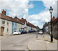
Ilchester houses [15]
Number 21 High Street, nearer the camera, and number 22 High Street are two little-altered cottages in a terrace built in or soon after 1820. Constructed of brick under tile roofs. Listed, grade II, with details at: https://historicengland.org.uk/listing/the-list/list-entry/1267505 (number 21) and at: https://historicengland.org.uk/listing/the-list/list-entry/1057299 (number 22).
Ilchester is a village in Somerset, situated astride the River Yeo or Ivel, some 4½ miles northwest of Yeovil and about 18 miles east of Taunton. Originally an important Roman town, Lindinis, on the Fosse Way and later a market town, in the medieval period Ilchester was the county town. It declined in size and importance and the last markets were held in 1833. The name was recorded in the Domesday Book as Givelcestre, meaning "Roman fort on the River Yeo".
Image: © Michael Dibb
Taken: 18 May 2023
0.09 miles
7
Ilchester: High Street
Looking north-north-east towards the Market Square. This was originally the Roman Fosse Way. With the village - or is it town - pharmacy on the right and the Dolphin inn beyond
Image: © Martin Bodman
Taken: 30 Jun 2012
0.09 miles
8
Ilchester: High Street
On the line of the Roman Fosse Way. This street was the scene of traffic jams until the A303 by-passed the town late in the twentieth century. Dolphin Inn on the left. The Manor House just visible at the end of the street, at the point where it becomes West Street
Image: © Martin Bodman
Taken: 30 Jun 2012
0.09 miles
9
River Yeo in Ilchester
Viewed looking downstream from Ilchester Bridge, the River Yeo is also known by its Old English name of the River Ivel. The name Ilchester is derived from the Old English 'Givelcestre' meaning 'The fort on the River Ivel'.
Image: © Nigel Cox
Taken: 12 May 2007
0.09 miles
10
The Dolphin Inn, Ilchester
Image: © Roger Cornfoot
Taken: 22 Nov 2017
0.09 miles


![Ilchester houses [13]](https://s1.geograph.org.uk/geophotos/07/51/22/7512229_dded43c6_120x120.jpg)
![Ilchester houses [15]](https://s3.geograph.org.uk/geophotos/07/51/22/7512235_b83bcb14_120x120.jpg)


