
IMAGES TAKEN NEAR TO
Alvington Lane, YEOVIL, BA22 8GE
Introduction
This page details the photographs taken nearby to Alvington Lane, BA22 8GE by members of the Geograph project.
The Geograph project started in 2005 with the aim of publishing, organising and preserving representative images for every square kilometre of Great Britain, Ireland and the Isle of Man.

There are currently over 7.5m images from over14,400 individuals and you can help contribute to the project by visiting https://www.geograph.org.uk
Image Map
Images are licensed for reuse under creativecommons.org/licenses/by-sa/2.0
Notes
- Clicking on the map will re-center to the selected point.
- The higher the marker number, the further away the image location is from the centre of the postcode.
Image Listing (20 Images Found)
Images are licensed for reuse under creativecommons.org/licenses/by-sa/2.0
Image
Details
Distance
1
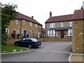
Clare Grange, Alvington
Up until a few years ago Alvington was a tiny cluster of houses close to the old Martock to Yeovil railway. The railway route was converted to the A3088 Cartgate link road and the expansion of Yeovil meant this quiet corner was bound to be developed. Several developments are taking place around the old village. Clare Mews and Clare Grange shown here are the closest ones to the A3088.
Image: © Nigel Mykura
Taken: 1 May 2009
0.02 miles
2
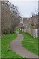
Yeovil : Footpath
A footpath around the housing estate which leads from Alvington Lane to Bluebell Road.
Image: © Lewis Clarke
Taken: 16 Mar 2012
0.03 miles
3

Yeovil : Alvington Lane
Alvington Lane on the outskirts of Yeovil in South Somerset.
Image: © Lewis Clarke
Taken: 16 Mar 2012
0.04 miles
4

Yeovil : Alvington Lane
Alvington Lane on the outskirts of Yeovil.
Image: © Lewis Clarke
Taken: 16 Mar 2012
0.05 miles

6

Cottages at Alvington
A hamlet on the fringe of the Yeovil suburbs, tucked away down a no through road, and a mixture of old and new. This pair of cottages on the corner, dating from 1702, is described at http://webapp1.somerset.gov.uk/her/details.asp?prn=56104 . Pedestrian routes at the left side of the building provide access to nearby estates.
Image: © Derek Harper
Taken: 30 Aug 2007
0.05 miles
7
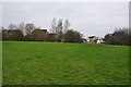
Yeovil : Grassy Field
A grassy field between the housing estate and A3088 road.
Image: © Lewis Clarke
Taken: 16 Mar 2012
0.06 miles
8

Highmere, Alvington
Highmere is the access road to one of several new developments on the south side of Yeovil around the ancient hamlet of Alvington sandwiched between the large town and the A3088 Cartgate link road.
Image: © Nigel Mykura
Taken: 1 May 2009
0.07 miles
9
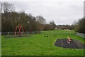
Yeovil : Children's Playground
A playground on Foxgle Way on what appears to be a relatively new estate on the outskirts of Yeovil.
Image: © Lewis Clarke
Taken: 16 Mar 2012
0.09 miles
10

Planning Application, Alvington
Planning application for the demolition of these barns in Alvington has been made recently. Despite the large amount of development that is taking place this is a conservation area.
Image: © Nigel Mykura
Taken: 1 May 2009
0.10 miles