IMAGES TAKEN NEAR TO
Englands Mead, YEOVIL, BA22 7NW
Introduction
This page details the photographs taken nearby to Englands Mead, BA22 7NW by members of the Geograph project.
The Geograph project started in 2005 with the aim of publishing, organising and preserving representative images for every square kilometre of Great Britain, Ireland and the Isle of Man.

There are currently over 7.5m images from over14,400 individuals and you can help contribute to the project by visiting https://www.geograph.org.uk
Image Map
Images are licensed for reuse under creativecommons.org/licenses/by-sa/2.0
Notes
- Clicking on the map will re-center to the selected point.
- The higher the marker number, the further away the image location is from the centre of the postcode.
Image Listing (29 Images Found)
Images are licensed for reuse under creativecommons.org/licenses/by-sa/2.0
Image
Details
Distance
1
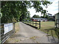
Queen Camel Bowls Club
Located at the end of Green Lane. The club was founded in 1948 by a colourful local man, Arthur Henry Armstrong, who was also a circuit judge. The club firstly used his lawn to play and had some contemporary rules: membership was open to 'any sober and respectable man of the age of forty years and upwards, resident in the parish of Queen Camel'. Another regulation of note stated: 'no member shall bring to any meeting of the club any cat, dog, child, female or any other destructive or distracting person, animal or thing whatsoever'.
Slowly the club grew and acquired funds for a better venue and a small pavilion was built in 1976. The buildings have been enlarged and improved on many occasions since. The club is open to all members these days and ladies form about a third.
Image: © Neil Owen
Taken: 19 Aug 2022
0.06 miles
2

Queen Camel playing field
Home to football and cricket, as well as things for the kids.
Image: © Neil Owen
Taken: 19 Aug 2022
0.06 miles
3
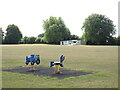
Whitewashing the pavilion
The work continues during fixtures.
Image: © Neil Owen
Taken: 19 Aug 2022
0.06 miles
4

Green Lane Sewage Pumping Station
A small facility in a quiet spot in the field. No-one works here as the station is automatic.
Image: © Neil Owen
Taken: 19 Aug 2022
0.07 miles
5
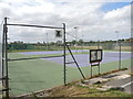
Queen Camel Tennis Club
Two floodlit hard courts for use by members.
Image: © Neil Owen
Taken: 19 Aug 2022
0.07 miles
6

Leland Trail near Queen Camel
Following the trail westwards through meadows towards West Camel
Image: © Chris Heaton
Taken: 19 May 2002
0.07 miles
7

Pack Bridge at the end of Dark Lane and Laurel Lane
An ancient crossing of the River Cam in Queen Camel.
Image: © Neil Owen
Taken: 19 Aug 2022
0.11 miles
8
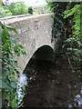
The bridge on Blackwell Lane
An ancient crossing, linking the road to the lanes at the north of the village.
Image: © Neil Owen
Taken: 19 Aug 2022
0.11 miles
9

Severe warnings on Blackwell Lane
Apparently this road is closed and, just to ensure users are fully aware, a very stern warning sign has been put up. There must be a grave danger up ahead for this sort of enforcement!
Image: © Neil Owen
Taken: 19 Aug 2022
0.11 miles