
IMAGES TAKEN NEAR TO
Cary Road, YEOVIL, BA22 7DJ
Introduction
This page details the photographs taken nearby to Cary Road, BA22 7DJ by members of the Geograph project.
The Geograph project started in 2005 with the aim of publishing, organising and preserving representative images for every square kilometre of Great Britain, Ireland and the Isle of Man.

There are currently over 7.5m images from over14,400 individuals and you can help contribute to the project by visiting https://www.geograph.org.uk
Image Map
Images are licensed for reuse under creativecommons.org/licenses/by-sa/2.0
Notes
- Clicking on the map will re-center to the selected point.
- The higher the marker number, the further away the image location is from the centre of the postcode.
Image Listing (54 Images Found)
Images are licensed for reuse under creativecommons.org/licenses/by-sa/2.0
Image
Details
Distance
1

The Catash Inn, North Cadbury
Interesting public house, although it is not quite where the map says it is.
Image: © Maigheach-gheal
Taken: 19 Oct 2008
0.02 miles
2

The Catash Inn, North Cadbury
Difficult to find out the origin of this Inn's unusual name. According to an excerp in "The History and Antiquities of the County of Somerset: With a Map ..., Volume 2; by John Collinson" the Hundred of Catash took its name from an ash tree in the road between Castle Cary and Yeovil where the court for the Hundred was held. The inn's sign shows a group of men around a table next to a tree http://www.geograph.org.uk/photo/1012964
Image: © Tim Heaton
Taken: 26 Feb 2014
0.03 miles
3
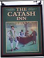
Sign for the Catash Inn, North Cadbury
The Catash Inn is named after the Hundred in which the parish lay.
Image: © Maigheach-gheal
Taken: 19 Oct 2008
0.04 miles
4

Barn conversion?
If so this is taking matters to extreme, just the end wall left standing and not even attached to the new building.
Image: © Graham Horn
Taken: 5 May 2007
0.04 miles
6

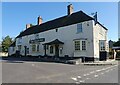
Catash Inn, North Cadbury
At the south-west corner of the junction of High Street and Cary Lane, and not as the 1:50K and 1:25K map symbols suggest, on the other side of the road.
Image: © Graham Horn
Taken: 5 May 2007
0.05 miles
7
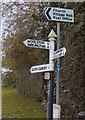
Direction Sign - Signpost opposite Woolston Road. North Cadbury
Pyramid finial - 3 arms; Somerset SCC pyramid by the UC road, in parish of North Cadbury (South Somerset District), on the west side of the T junction of Parish Hill and Woolston Road.
surveyed
Milestone Society National ID: SO_ST6327
Image: © Milestone Society
Taken: Unknown
0.05 miles
9
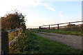
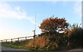
Farm track by Parish Hill, North Cadbury
Image: © David Howard
Taken: 20 Oct 2018
0.11 miles
10
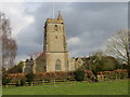
The church of St Michael, North Cadbury
Image: © Peter Wood
Taken: 13 Mar 2013
0.15 miles