IMAGES TAKEN NEAR TO
Galhampton, YEOVIL, BA22 7BE
Introduction
This page details the photographs taken nearby to BA22 7BE by members of the Geograph project.
The Geograph project started in 2005 with the aim of publishing, organising and preserving representative images for every square kilometre of Great Britain, Ireland and the Isle of Man.

There are currently over 7.5m images from over14,400 individuals and you can help contribute to the project by visiting https://www.geograph.org.uk
Image Map
Images are licensed for reuse under creativecommons.org/licenses/by-sa/2.0
Notes
- Clicking on the map will re-center to the selected point.
- The higher the marker number, the further away the image location is from the centre of the postcode.
Image Listing (12 Images Found)
Images are licensed for reuse under creativecommons.org/licenses/by-sa/2.0
Image
Details
Distance
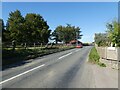
5
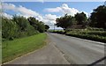
A359 near Barrow Court
Looking in the opposite direction from the same spot as Image The building on the right by the trees is the lodge for Barrow Court.
Image: © Derek Harper
Taken: 17 Jul 2016
0.15 miles
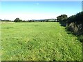
6
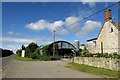
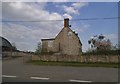
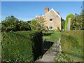
Fir Tree Farm
By the A359 south of Galhampton.
Image: © Derek Harper
Taken: 17 Jul 2016
0.20 miles
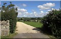
10
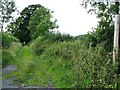
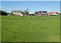
Footpath opposite the road to North Cadbury
Image: © David Gearing
Taken: 6 Aug 2011
0.24 miles