
IMAGES TAKEN NEAR TO
Cameley Green, BATH, BA2 1SB
Introduction
This page details the photographs taken nearby to Cameley Green, BA2 1SB by members of the Geograph project.
The Geograph project started in 2005 with the aim of publishing, organising and preserving representative images for every square kilometre of Great Britain, Ireland and the Isle of Man.

There are currently over 7.5m images from over14,400 individuals and you can help contribute to the project by visiting https://www.geograph.org.uk
Image Map
Images are licensed for reuse under creativecommons.org/licenses/by-sa/2.0
Notes
- Clicking on the map will re-center to the selected point.
- The higher the marker number, the further away the image location is from the centre of the postcode.
Image Listing (8 Images Found)
Images are licensed for reuse under creativecommons.org/licenses/by-sa/2.0
Image
Details
Distance
1
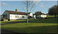
Houses by Newton Road, Twerton
The house on the left appears in Image The cars are parked on Cameley Green.
Image: © Derek Harper
Taken: 9 Dec 2019
0.10 miles
3
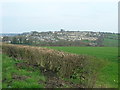
Twerton seen from the west
Twerton seen from the hillside east of Newton St Loe.
Image: © James Ayres
Taken: 10 Apr 2010
0.16 miles
4
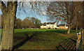
Houses by recreation ground, Twerton
Houses on Pennyquick View seen across Pennyquick Park from Newton Road.
Image: © Derek Harper
Taken: 9 Dec 2019
0.17 miles
5

Basketball half court, Pennyquick Park
Image: © Derek Harper
Taken: 9 Dec 2019
0.18 miles
6
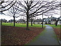
Day Crescent, Twerton
Bath's famous Georgian crescents have influenced the layout of later social housing. Twerton boasts a couple of oval developments as well as this semi-circular one.
Image: © HelenK
Taken: 12 Jan 2013
0.19 miles
7
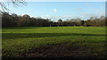
Pennyquick Park
Goal posts at the southwestern side of the recration ground. This was formerly the site of Pennyquick Colliery and Quarry. "Opened in 1840, the spoil heap has been landscaped as a playing field. When it closed, the quarry was filled with demolition material from the 1942 blitz bombing on Bath" http://www.riveravontrail.org.uk/archive/carrs_wood_leaflet.pdf .
Image: © Derek Harper
Taken: 9 Dec 2019
0.19 miles
8

Junction, Newton Road
The road from Bath Mill Lodge Retreat (shown in Image]) reaches a T junction with the road to Twerton.
Image: © Derek Harper
Taken: 9 Dec 2019
0.24 miles