
IMAGES TAKEN NEAR TO
Roundhill Park, BATH, BA2 1NN
Introduction
This page details the photographs taken nearby to Roundhill Park, BA2 1NN by members of the Geograph project.
The Geograph project started in 2005 with the aim of publishing, organising and preserving representative images for every square kilometre of Great Britain, Ireland and the Isle of Man.

There are currently over 7.5m images from over14,400 individuals and you can help contribute to the project by visiting https://www.geograph.org.uk
Image Map
Images are licensed for reuse under creativecommons.org/licenses/by-sa/2.0
Notes
- Clicking on the map will re-center to the selected point.
- The higher the marker number, the further away the image location is from the centre of the postcode.
Image Listing (33 Images Found)
Images are licensed for reuse under creativecommons.org/licenses/by-sa/2.0
Image
Details
Distance
1
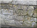
Ordnance Survey Cut Mark
This OS cut mark can be found on No161 The Hollow. It marks a point 116.259m above mean sea level.
Image: © Adrian Dust
Taken: 2 Dec 2022
0.03 miles
2
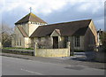
Southdown Methodist Church
A view looking east across The Hollow, towards the Methodist Church at Southdown.
Image: © Phil Williams
Taken: 9 Mar 2007
0.04 miles
3

Southdown Methodist Church Centre
The nearby Methodist church in Oldfield Park closed a few years ago, but the church remains active in the area at this complex of church buildings.
Image: © HelenK
Taken: 14 Sep 2013
0.05 miles
4
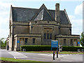
Haycombe Cemetery Entrance, Bath
A very beautiful place, with fine views to the rear
Image: © Rick Crowley
Taken: 19 May 2011
0.11 miles
5
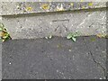
Ordnance Survey Cut Mark
This OS cut mark can be found on the cemetery wall on Whiteway Road. It marks a point 120.239m above mean sea level.
Image: © Adrian Dust
Taken: 16 Nov 2022
0.12 miles
6
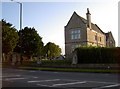
Haycombe Cemetery and Crematorium
A smaller office is located to the right of the entrance, and a benchmark is cut into the pillar to the right of the lamppost. See Image] for a closer view.
Image: © Neil Owen
Taken: 10 Sep 2011
0.12 miles
7
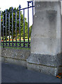
Benchmark near Haycombe Cemetery entrance
A cut mark (as listed in the Benchmark Database: http://www.bench-marks.org.uk/bm39520 ) on the second pillar from the entrance. See Image] for a contextual view.
Image: © Neil Owen
Taken: 10 Sep 2011
0.12 miles
8

Shops at Southdown
A view looking to the southeast along The Mount towards the shops at Southdown.
Image: © Phil Williams
Taken: 9 Mar 2007
0.12 miles
9
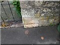
Ordnance Survey Cut Mark
This OS cut mark can be found on the gatepost of No70 Mount Road. It marks a point 114.521m above mean sea level.
Image: © Adrian Dust
Taken: 2 Dec 2022
0.14 miles
10
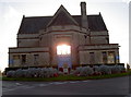
The eternal light?
Haycombe Cemetery and Crematorium, Bath. The early evening September light shines through both window areas, lending an ethereal glow from the right place. See Image] for the other side of the building.
Image: © Neil Owen
Taken: 10 Sep 2011
0.15 miles