
IMAGES TAKEN NEAR TO
Percy Road, YEOVIL, BA21 5AJ
Introduction
This page details the photographs taken nearby to Percy Road, BA21 5AJ by members of the Geograph project.
The Geograph project started in 2005 with the aim of publishing, organising and preserving representative images for every square kilometre of Great Britain, Ireland and the Isle of Man.

There are currently over 7.5m images from over14,400 individuals and you can help contribute to the project by visiting https://www.geograph.org.uk
Image Map
Images are licensed for reuse under creativecommons.org/licenses/by-sa/2.0
Notes
- Clicking on the map will re-center to the selected point.
- The higher the marker number, the further away the image location is from the centre of the postcode.
Image Listing (26 Images Found)
Images are licensed for reuse under creativecommons.org/licenses/by-sa/2.0
Image
Details
Distance
1
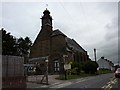
St Michael's Hall, Yeovil
The Image which lies behind Image can be glimpsed over the roof tops from odd spots around the area.
Image: © Steve Barnes
Taken: 12 Aug 2009
0.10 miles
2

The Church of St Michael at Yeovil
Viewed from the road to the west.
Image: © Peter Wood
Taken: 31 Mar 2014
0.10 miles
3

Weathered benchmark on base of gatepost at entrance to St Michael & All Angels' Church
Ordnance Survey cut mark benchmark described on the Bench Mark Database at http://www.bench-marks.org.uk/bm37107
Image: © Roger Templeman
Taken: 19 Feb 2011
0.11 miles
4
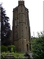
St Michael's Church, Yeovil
By a strange coincidence this church is on St Michael's Avenue.
Image: © Steve Barnes
Taken: 12 Aug 2009
0.11 miles
5
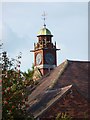
Clock tower of St Michael's Hall
Hidden behind the church and school this clock tower on Image can be seen from across the rooftops.
Image: © Steve Barnes
Taken: 9 Aug 2009
0.11 miles
6

The Green Dragon
The Green Dragon public house following its refurbishment.
Image: © Steve Barnes
Taken: 21 Aug 2009
0.14 miles
7
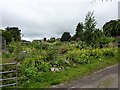
Goar Knapp Allotments
These allotments are quite hard to find as well as to pronounce.
Image: © Steve Barnes
Taken: 12 Aug 2009
0.17 miles
8
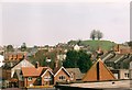
View across to Wyndham Hill from above Yeovil bus station
Looking from the very edge of the Quedam shopping centre by the escalator down to Glovers Walk and the bus station. Wyndham Hill is instantly recognisable with its four trees on top, and offers great views over the whole of Yeovil.
Image: © Jim Champion
Taken: Unknown
0.18 miles
9
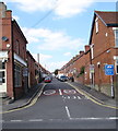
Southern end of Cromwell Road, Yeovil
Viewed across Lyde Road. The 30mph speed limit drops to 20mph on the approach to a school.
The blue sign on the right shows that this is an unsuitable route for heavy goods vehicles.
Image: © Jaggery
Taken: 10 Sep 2015
0.19 miles
10

The Royal Marine Inn, Yeovil
This inn has been trading in Yeovil since 1886.
Image: © Steve Barnes
Taken: 12 Aug 2009
0.20 miles