
IMAGES TAKEN NEAR TO
Highfield Road, YEOVIL, BA21 4RW
Introduction
This page details the photographs taken nearby to Highfield Road, BA21 4RW by members of the Geograph project.
The Geograph project started in 2005 with the aim of publishing, organising and preserving representative images for every square kilometre of Great Britain, Ireland and the Isle of Man.

There are currently over 7.5m images from over14,400 individuals and you can help contribute to the project by visiting https://www.geograph.org.uk
Image Map
Images are licensed for reuse under creativecommons.org/licenses/by-sa/2.0
Notes
- Clicking on the map will re-center to the selected point.
- The higher the marker number, the further away the image location is from the centre of the postcode.
Image Listing (14 Images Found)
Images are licensed for reuse under creativecommons.org/licenses/by-sa/2.0
Image
Details
Distance
1
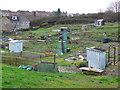
Allotments, Yeovil
These are on the eastern side of Yeovil in the most working class part of town
Image: © Nigel Mykura
Taken: 16 Jan 2008
0.11 miles
3
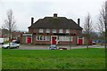
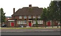
The Milford Inn
This pub is close to the centre of one of the main council estates on the eastern side of Yeovil
Image: © Nigel Mykura
Taken: 31 Jan 2009
0.13 miles

5
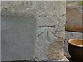
Benchmark on #164 St Michael's Avenue, Yeovil
Ordnance Survey benchmark, described on database at http://www.bench-marks.org.uk/bm68521.
Image: © Becky Williamson
Taken: 29 Jun 2015
0.16 miles
6

The Green Dragon
The Green Dragon public house following its refurbishment.
Image: © Steve Barnes
Taken: 21 Aug 2009
0.18 miles
7
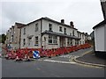
Yet another former Yeovil pub
This former public house at the intersection of Eastland and Highfield Roads is shown in the process of being converted into flats.
Image: © Steve Barnes
Taken: 12 Aug 2009
0.18 miles

9
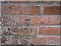
Worn benchmark on roadside face of wall at junction of nos. 19 and 21 Mount Pleasant, Yeovil
Ordnance Survey benchmark, described on database at http://www.bench-marks.org.uk/bm37106.
Image: © Becky Williamson
Taken: 29 Jun 2015
0.22 miles
10

Millford Dip Allotments
These are now the only remaining allotments on Milford Road
Image: © Steve Barnes
Taken: 19 Jul 2009
0.23 miles