IMAGES TAKEN NEAR TO
Mudford Road, YEOVIL, BA21 4NZ
Introduction
This page details the photographs taken nearby to Mudford Road, BA21 4NZ by members of the Geograph project.
The Geograph project started in 2005 with the aim of publishing, organising and preserving representative images for every square kilometre of Great Britain, Ireland and the Isle of Man.

There are currently over 7.5m images from over14,400 individuals and you can help contribute to the project by visiting https://www.geograph.org.uk
Image Map (Loading...)


Getting Data...Please wait
Leaflet Map data © OpenStreetMap
Images are licensed for reuse under creativecommons.org/licenses/by-sa/2.0
Notes
- Clicking on the map will re-center to the selected point.
- The higher the marker number, the further away the image location is from the centre of the postcode.
Image Listing (5 Images Found)
Images are licensed for reuse under creativecommons.org/licenses/by-sa/2.0
Image
Details
Distance
1
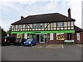
Entrance, Fairmead Community Special School
Image: © Roger Cornfoot
Taken: 18 Jul 2018
0.05 miles

4

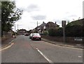
Direction Sign - Signpost on the A359 in Mudford parish
Pyramid finial - 3 arms; Somerset SCC pyramid by the A359, in parish of Mudford (South Somerset District), on the west side of the T junction of the A359 Mudford Hill and Lyde Road.
surveyed
Milestone Society National ID: SO_ST5618
Image: © Milestone Society
Taken: Unknown
0.20 miles