IMAGES TAKEN NEAR TO
Red Hill, BATH, BA2 0PA
Introduction
This page details the photographs taken nearby to Red Hill, BA2 0PA by members of the Geograph project.
The Geograph project started in 2005 with the aim of publishing, organising and preserving representative images for every square kilometre of Great Britain, Ireland and the Isle of Man.

There are currently over 7.5m images from over14,400 individuals and you can help contribute to the project by visiting https://www.geograph.org.uk
Image Map
Images are licensed for reuse under creativecommons.org/licenses/by-sa/2.0
Notes
- Clicking on the map will re-center to the selected point.
- The higher the marker number, the further away the image location is from the centre of the postcode.
Image Listing (21 Images Found)
Images are licensed for reuse under creativecommons.org/licenses/by-sa/2.0
Image
Details
Distance
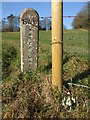
1
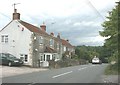
2007: Camerton Road, nr Meadgate
Coming from Meadgate we are about to follow the car down the hill to Camerton.
Image: © Maurice Pullin
Taken: 10 Jul 2007
0.08 miles
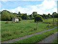
2
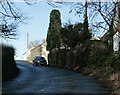
2009 : Looking north up Camerton Road
Climbing the hill from Camerton, a little over half way up, a group of houses and some farm buildings at the top.
Image: © Maurice Pullin
Taken: 20 Dec 2009
0.08 miles
3
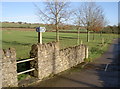
Choose your path
A couple of footpaths for a traveller's delight. The right-hand path goes down to Sheep House Farm and the old workings; the left goes up the hill to Meadgate - although you might as well just walk up the road!
Image: © Neil Owen
Taken: 11 Jan 2013
0.10 miles
4
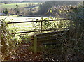
A country seat
A bench for the weary travelling up from Camerton, looking rather unloved and forgotten.
Image: © Neil Owen
Taken: 11 Jan 2013
0.12 miles
5
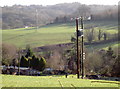
When I grow up I want to be like that
A small electricity transformer taking power to a residential site, looking on wistfully to a larger and higher voltage tower on the other side of the Cam Brook valley.
Image: © Neil Owen
Taken: 11 Jan 2013
0.16 miles
6
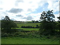
From the coal statue to the coal canal (13)
Countryside to the north of The Limestone Link https://en.wikipedia.org/wiki/Limestone_Link
Image: © Basher Eyre
Taken: 14 Sep 2013
0.19 miles
7
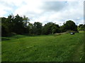
From the coal statue to the coal canal (15)
Verdant pasture after heavy overnight rain
Image: © Basher Eyre
Taken: 14 Sep 2013
0.19 miles
8
Main below
Some seasonal snowdrops mark the waters that are carried underground.
Image: © Neil Owen
Taken: 30 Jan 2019
0.20 miles
9
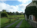
From the coal statue to the coal canal (10)
A water board building?
Image: © Basher Eyre
Taken: 14 Sep 2013
0.20 miles
10
From the coal statue to the coal canal (11)
The Limestone Link passes a cottage
Image: © Basher Eyre
Taken: 14 Sep 2013
0.20 miles