
IMAGES TAKEN NEAR TO
The Avenue, BATH, BA2 0HU
Introduction
This page details the photographs taken nearby to The Avenue, BA2 0HU by members of the Geograph project.
The Geograph project started in 2005 with the aim of publishing, organising and preserving representative images for every square kilometre of Great Britain, Ireland and the Isle of Man.

There are currently over 7.5m images from over14,400 individuals and you can help contribute to the project by visiting https://www.geograph.org.uk
Image Map
Images are licensed for reuse under creativecommons.org/licenses/by-sa/2.0
Notes
- Clicking on the map will re-center to the selected point.
- The higher the marker number, the further away the image location is from the centre of the postcode.
Image Listing (58 Images Found)
Images are licensed for reuse under creativecommons.org/licenses/by-sa/2.0
Image
Details
Distance
1
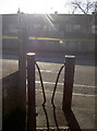
A certain stile
The path alongside the burial grounds on The Avenue has a characteristic set of bollards to prevent larger traffic. There are a number of similar ones dotted around the village.
Image: © Neil Owen
Taken: 9 Feb 2015
0.01 miles
2
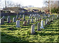
Timsbury burial ground
Looking across the rows of graves and on to the lychgate at the far end, the grounds were enlarged before WWII. Today there is precious little space left and moves are being made to find a new cemetery. See Image] for the lychgate.
Image: © Neil Owen
Taken: 9 Feb 2015
0.02 miles
3
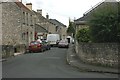
2007 : High Street, Timsbury
Timsbury is mentioned in the Domesday Book.
From about 1800 it was a mining town in the North Somerset coalfield, this has now ceased.
St. Mary's Church is at the far end of High Street.
Image: © Maurice Pullin
Taken: 10 Jul 2007
0.04 miles
4
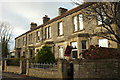
Pitfour Terrace, Timsbury
A terrace of five on the High Street.
Image: © Derek Harper
Taken: 9 Dec 2019
0.04 miles
5
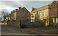
Houses on High Street, Timsbury
On the left is Pitfour Terrace, shown in Image On the right is the mid C17 Pitfour House https://historicengland.org.uk/listing/the-list/list-entry/1129599 , with information on the former occupants at http://www.timsbury.org.uk/pitfour-house/ . The gatepiers with ball finials, rather hidden in shadow on the left, are also listed https://historicengland.org.uk/listing/the-list/list-entry/1136004 .
Image: © Derek Harper
Taken: 9 Dec 2019
0.04 miles
6
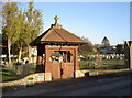
Timsbury burials
The village has a number of churches but this burial ground is distinctly separate from them. The original plot was acquired around the turn of the century, close to the Conygre Colliery, and was about one third of the current size. The lychgate marks the entrance. See Image] for another view.
Image: © Neil Owen
Taken: 9 Feb 2015
0.04 miles
7
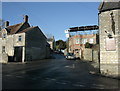
2009 : Church Hill Timsbury
The Guss and Crook public house is to the right.
Image: © Maurice Pullin
Taken: 20 Dec 2009
0.05 miles
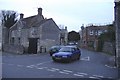
9
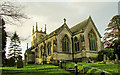
St Mary the Virgin's church, Timsbury
Prtty much the view in Image, at a slightly wider angle. The grade II* listed church dates from "1826-32, east end of 1852 by Sir George G. Scott" https://historicengland.org.uk/listing/the-list/list-entry/1129594 .
Image: © Derek Harper
Taken: 9 Dec 2019
0.07 miles
10
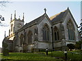
St Mary's, Timsbury
Timsbury has its origins somewhere in Anglo-Saxon times, but there appears to have been some form of place of worship by Domesday. Certainly, by the late thirteenth century a church was established for the little gathering of houses and farms here. One of the local lords of the manor, Sir Barnaby Samborne (standard bearer to Elizabeth I), was enshrined in the churchyard and somehow evaded the destructive efforts of the Puritans.
However, the church found more trouble with general dilapidation and the lot had to be demolished in 1820. It was rebuilt in 1826 based on designs by no less a luminary than Sir George Gilbert Scott; side aisles were added in 1852. See Image] for more views.
Image: © Neil Owen
Taken: 9 Feb 2015
0.07 miles