
IMAGES TAKEN NEAR TO
Pennsylvania View, BATH, BA1 9DW
Introduction
This page details the photographs taken nearby to Pennsylvania View, BA1 9DW by members of the Geograph project.
The Geograph project started in 2005 with the aim of publishing, organising and preserving representative images for every square kilometre of Great Britain, Ireland and the Isle of Man.

There are currently over 7.5m images from over14,400 individuals and you can help contribute to the project by visiting https://www.geograph.org.uk
Image Map
Images are licensed for reuse under creativecommons.org/licenses/by-sa/2.0
Notes
- Clicking on the map will re-center to the selected point.
- The higher the marker number, the further away the image location is from the centre of the postcode.
Image Listing (23 Images Found)
Images are licensed for reuse under creativecommons.org/licenses/by-sa/2.0
Image
Details
Distance
1
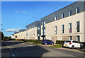
Fairways, Ensleigh
Part of the new suburb of Ensleigh which has been built on a former MOD depot.
Image: © Des Blenkinsopp
Taken: 9 Sep 2020
0.05 miles
2
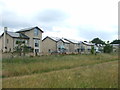
Chelscombe Close
A varied selection of houses, part of the new housing development to the north west of Bath. The site was recently redeveloped from the old M.O.D. Ensleigh (Naval) base.
Image: © Neil Owen
Taken: 8 Jun 2020
0.10 miles
3
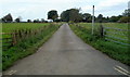
Access lane to Charlcombe Grove Farm near Bath
Viewed from the corner of Colliers Lane and Granville Road.
Image: © Jaggery
Taken: 24 Sep 2011
0.12 miles
4

The boundary of Kingswood Upper playing field
On the other side of the wall is Charlcombe Grove Farm. The bird life changes on this high open ground, with both swallows and skylarks in evidence.
Image: © HelenK
Taken: 16 May 2012
0.15 miles
5
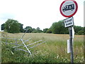
A crunch on Collier's Lane
Someone has had a bit of a headache, presumably a light vehicle.
Image: © Neil Owen
Taken: 8 Jun 2020
0.16 miles
6
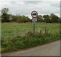
Weight restriction (except buses) along Colliers Lane, Bath
Viewed from the corner of Granville Road.
Image: © Jaggery
Taken: 24 Sep 2011
0.16 miles
7
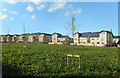
A bit of open space
No doubt intended as a bit of a park in the middle of the surrounding new housing, I suspect this year's hot summer has killed off most of the grass and new trees and now there's just a healthy crop of weeds. I'm sure it will be ok eventually.
Image: © Des Blenkinsopp
Taken: 9 Sep 2020
0.16 miles
8
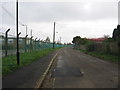
Granville Road
The MoD site (DLO Ensleigh) on the left is nearing the end of its life. The house being built on the right is one of several that are being tucked in between others round here and it will probably be joined by more new housing on the former MoD land.
Image: © HelenK
Taken: 25 Sep 2011
0.17 miles
9
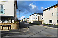
Beckford Drive, Ensleigh
A new edge of town housing development on the site of a former MOD depot. The road is named after William Beckford, builder of the nearby landmark Beckford's Tower.
Image: © Des Blenkinsopp
Taken: 9 Sep 2020
0.17 miles
10

Concrete ruin
A sizeable concrete and largely windowless building has been left to fall into ruin, though it probably looked little better when it had a roof. Possibly it may have been connected with the nearby Ensleigh MoD site. Seen from just inside Kingswood School playing fields.
Image: © HelenK
Taken: 16 May 2012
0.19 miles