
IMAGES TAKEN NEAR TO
Charmy Down, BATH, BA1 8AG
Introduction
This page details the photographs taken nearby to BA1 8AG by members of the Geograph project.
The Geograph project started in 2005 with the aim of publishing, organising and preserving representative images for every square kilometre of Great Britain, Ireland and the Isle of Man.

There are currently over 7.5m images from over14,400 individuals and you can help contribute to the project by visiting https://www.geograph.org.uk
Image Map
Images are licensed for reuse under creativecommons.org/licenses/by-sa/2.0
Notes
- Clicking on the map will re-center to the selected point.
- The higher the marker number, the further away the image location is from the centre of the postcode.
Image Listing (19 Images Found)
Images are licensed for reuse under creativecommons.org/licenses/by-sa/2.0
Image
Details
Distance
1

2008 : Wingfield Farm
The transmitter mast in the distance is on Lansdown, by the racecourse.
Image: © Maurice Pullin
Taken: 8 Apr 2008
0.05 miles
2
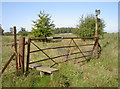
A gate with stile
There's something odd about this little set-up. Just how does the gate open with a stile running through it? Presumably the gate is no longer used.
Image: © Neil Owen
Taken: 7 Sep 2015
0.13 miles
3
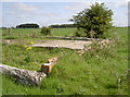
Down to ground level
One of the many old buildings that used to be part of R.A.F. Charmy Down, now reduced to foundation level. Trees now find a way through the concrete.
Image: © Neil Owen
Taken: 7 Sep 2015
0.15 miles
4
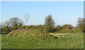
Aircraft Dispersal Pens or Revetments
These were used to park and protect planes from attack in world war two.
Image: © Rick Crowley
Taken: 17 Apr 2010
0.16 miles
5
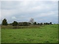
Foundations of demolished WW2 military buildings on the edge of Charmy Down airfield
Image: © Dr Duncan Pepper
Taken: 18 Oct 2015
0.16 miles
6
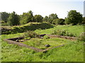
Dispersed to nature
R.A.F. Charmy Down was used for while after the end of the Second World War, but has been left to agriculture and Mother Nature for many years now. The foundations of a small building and an aircraft pen embankment are all that are visible.
Image: © Neil Owen
Taken: 7 Sep 2015
0.17 miles
7

Runway ironmongery
The old runways of the former R.A.F. Charmy Down used to be tarmac when it was an active station, but now grass has resumed its occupation. However, the place is still occasionally used by light aircraft. The old and hauntingly derelict control tower is in the distance.
Image: © Neil Owen
Taken: 7 Sep 2015
0.18 miles
8

A farm path
The numerous footpaths on Charmy Down often meet up; there are three at the entrance by Wingfield Farm. The woodwork is tended by the Cotswold Voluntary Wardens.
Image: © Neil Owen
Taken: 7 Sep 2015
0.18 miles
9

For walkers old and new
Two different styles of sign, each pointing to a different path. Unfortunately, the top of the post is badly corroded and looks like it will fall before too long.
Image: © Neil Owen
Taken: 7 Sep 2015
0.18 miles
10

Still a landing ground
The old runways of Charmy Down were once tarmac and used by British and American aviators. Now disused by the military for some years and returned to grass, it is still used by modern light aircraft occasionally.
Image: © Neil Owen
Taken: 7 Sep 2015
0.19 miles