
IMAGES TAKEN NEAR TO
Catherine Way, BATH, BA1 7NY
Introduction
This page details the photographs taken nearby to Catherine Way, BA1 7NY by members of the Geograph project.
The Geograph project started in 2005 with the aim of publishing, organising and preserving representative images for every square kilometre of Great Britain, Ireland and the Isle of Man.

There are currently over 7.5m images from over14,400 individuals and you can help contribute to the project by visiting https://www.geograph.org.uk
Image Map
Images are licensed for reuse under creativecommons.org/licenses/by-sa/2.0
Notes
- Clicking on the map will re-center to the selected point.
- The higher the marker number, the further away the image location is from the centre of the postcode.
Image Listing (17 Images Found)
Images are licensed for reuse under creativecommons.org/licenses/by-sa/2.0
Image
Details
Distance
1
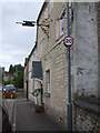
The end of the Northend Inn
This present-day house was originally a late seventeenth century house in Northend. It became an inn and served for many years, undergoing a number of alterations and changes. Now it has gone full circle and is a private residence, although the sign brackets remain.
Image: © Neil Owen
Taken: 8 Jun 2020
0.13 miles
2
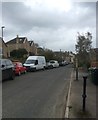
Batheaston North End
North End straggles up the valley with narrow roads and dead ends. Road access from the rest of Batheaston is restricted to the road that runs past the church; another possible route at the top of Catherine Way is blocked off. The former North End Inn was in this street until it shut in 2010.
Image: © HelenK
Taken: 15 Apr 2018
0.13 miles
3
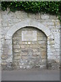
The old school entrance
The Batheaston Society has marked this blocked off entrance as from the old school 1818-59.
Image: © Neil Owen
Taken: 8 Jun 2020
0.16 miles
4

St John the Baptist
Church at Northend, Bath.
Image: © Wayland Smith
Taken: 11 Oct 2020
0.18 miles
5
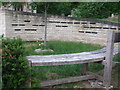
Cemetery Wall
A curved stone wall feature in the grounds of St John in Batheaston is a modern area where the departed are remembered by plaques in the wall.
Image: © Neil Owen
Taken: 8 Jun 2020
0.18 miles
6
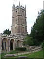
Old and new church structures
The extant St John the Baptist was founded in 1216, with the magnificent four stage tower arriving in 1460. The tower was reworked in 1834 by John Pinch the younger and stands at 94' (29m) tall. In front of it is the Cemetery Wall - see Image
Image: © Neil Owen
Taken: 8 Jun 2020
0.18 miles
7
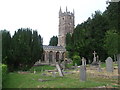
St John's church and grounds in Batheaston
The thirteenth century church and its graveyard.
Image: © Neil Owen
Taken: 8 Jun 2020
0.19 miles
8

Batheaston war memorial
The forty-four war dead of the old village of Batheaston are recorded in this memorial in the grounds of St John the Baptist. It was dedicated in a ceremony in 1920 and is partly based on a fifteenth century design.
Image: © Neil Owen
Taken: 8 Jun 2020
0.19 miles
9
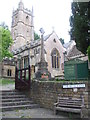
The steps up to St John the Baptist
Batheaston's church dates from the thirteenth century, although there are records that show a priest in the village in 1180. The war memorial stands close by.
Image: © Neil Owen
Taken: 8 Jun 2020
0.19 miles
10

Looking south-southeast down Brow Hill
Image: © Basher Eyre
Taken: 15 Sep 2013
0.19 miles