
IMAGES TAKEN NEAR TO
The Copse, BA1 7DJ
Introduction
This page details the photographs taken nearby to The Copse, BA1 7DJ by members of the Geograph project.
The Geograph project started in 2005 with the aim of publishing, organising and preserving representative images for every square kilometre of Great Britain, Ireland and the Isle of Man.

There are currently over 7.5m images from over14,400 individuals and you can help contribute to the project by visiting https://www.geograph.org.uk
Image Map
Images are licensed for reuse under creativecommons.org/licenses/by-sa/2.0
Notes
- Clicking on the map will re-center to the selected point.
- The higher the marker number, the further away the image location is from the centre of the postcode.
Image Listing (24 Images Found)
Images are licensed for reuse under creativecommons.org/licenses/by-sa/2.0
Image
Details
Distance
1
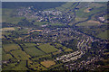
Bath And North East Somerset : Aerial Scenery
Looking down towards Batheaston.
Image: © Lewis Clarke
Taken: 18 Jun 2017
0.10 miles
2
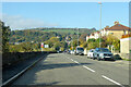
London Road East, Batheaston
No longer a major road, more recent roads have supplanted it.
Image: © Robin Webster
Taken: 13 Nov 2022
0.11 miles
3
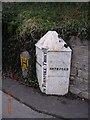
Old Boundary Marker by London Road East, Batheaston
Parish Boundary Marker - Turnpike by the UC road (was A4), in parish of Batheaston (North Somerset District), London Road East, outside No 307, at junction with Morris Lane, Batheaston, on pavement against wall.
Inscription reads:-
: BATHEASTON : : 1827 / BATH TURNPIKE TRUST : : BATHFORD :
Grade II listed.
List Entry Number: 1137592 https://historicengland.org.uk/listing/the-list/list-entry/1137592
Surveyed
Milestone Society National ID: SO_BACH02pb
Image: © Milestone Society
Taken: Unknown
0.13 miles
4
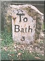
Old Milestone by Bannerdown Road, Batheaston
Metal plate attached to stone post by the UC road, in parish of BATHEASTON (BATH AND NORTH EAST SOMERSET District), Bannerdown Road, Batheaston, on grass verge, on South side of road. Bath incised iron plate, erected by the Bath turnpike trust in the 18th century.
Inscription reads:-
To
Bath
3
Grade II listed. List Entry Number: 1320520
https://historicengland.org.uk/listing/the-list/list-entry/1320520
Milestone Society National ID: SO_BARR03
Image: © JR Dowding
Taken: Unknown
0.15 miles
5

Old Milestone by Bannerdown Road, Batheaston
Metal plate attached to stone post by the UC road, in parish of BATHEASTON (BATH AND NORTH EAST SOMERSET District), Bannerdown Road, Batheaston, on grass verge, on South side of road. Bath incised iron plate, erected by the Bath turnpike trust in the 18th century. Alternative view see https://www.geograph.org.uk/photo/6035912
Inscription reads:- : To / Bath / 3 :
Milestone Society National ID: SO_BARR03
Image: © Janet Dowding
Taken: 3 Apr 2008
0.15 miles
6
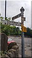
Direction Sign ? Signpost
Located on the east side of a roundabout on the junction of London Road East and Bannerdown Road in Batheaston parish. 3 arms, 1 missing and pyramid finial.
Milestone Society National ID: SO_ST7867
Image: © A Newton
Taken: 26 Jul 2020
0.18 miles
7
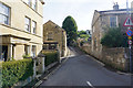
Fosse Lane, Batheaston
A no-through route up the side of Banner Down.
Image: © Bill Boaden
Taken: 25 Jul 2016
0.18 miles
8

Batheaston : London Road East
Looking along the road from the roundabout.
Image: © Lewis Clarke
Taken: 18 Oct 2022
0.19 miles
9
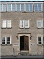
Entrance to the former Poor House, London Road East, Batheaston
Showing the date 1821. The plaque over the door appears to be blank.
Image: © Humphrey Bolton
Taken: 16 Nov 2010
0.19 miles
10
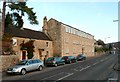
The former Poor House, London Road East, Batheaston
Dated 1821, see Image The English Heritage listing states that alternate windows of the long row on the second floor were originally blocked, although it would seem reasonable to suppose that this poor was intended as a workshop, perhaps with hand looms, to give the poor an occupation. The pair of 18C houses to the left are also listed buildings.
Image: © Humphrey Bolton
Taken: 16 Nov 2010
0.19 miles