
IMAGES TAKEN NEAR TO
Lambridge Mews, BATH, BA1 6QE
Introduction
This page details the photographs taken nearby to Lambridge Mews, BA1 6QE by members of the Geograph project.
The Geograph project started in 2005 with the aim of publishing, organising and preserving representative images for every square kilometre of Great Britain, Ireland and the Isle of Man.

There are currently over 7.5m images from over14,400 individuals and you can help contribute to the project by visiting https://www.geograph.org.uk
Image Map
Images are licensed for reuse under creativecommons.org/licenses/by-sa/2.0
Notes
- Clicking on the map will re-center to the selected point.
- The higher the marker number, the further away the image location is from the centre of the postcode.
Image Listing (71 Images Found)
Images are licensed for reuse under creativecommons.org/licenses/by-sa/2.0
Image
Details
Distance
1
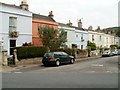
Beaufort Place, Bath
There are houses on only one side of Beaufort Place here.
The houses face the backs of houses in Victoria Place. http://www.geograph.org.uk/photo/3343255
Image: © Jaggery
Taken: 24 Sep 2011
0.03 miles
2
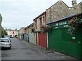
Beaufort Mews, Bath
Viewed from the St Saviour's Road end looking towards Beaufort Place.
Former horse stables have been converted to garages.
Image: © Jaggery
Taken: 24 Sep 2011
0.03 miles
3
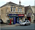
Post office and McColl's, Larkhall, Bath
Larkhall's post office is inside this McColl's shop and off-licence
located in 7 Lambridge Buildings in the NE of Bath.
Image: © Jaggery
Taken: 24 Sep 2011
0.06 miles
4
St. Saviour's Road, Larkhall
Looking north-east away from Bath city centre.
Spot the Moggie!
Image: © Jonathan Billinger
Taken: 25 Nov 2009
0.06 miles
5
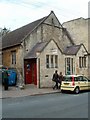
The Rondo Theatre, Bath
Located in St Saviours Road in the Larkhall area of NE Bath.
The inscription in stone on the building shows
ST SAVIOURS PARISH ROOM.
Image: © Jaggery
Taken: 24 Sep 2011
0.07 miles
6
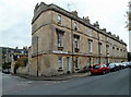
Grade II listed Victoria Place, Larkhall, Bath
Victoria Place is a separately-named row of houses extending for 55 metres along St Saviour's Road from the corner of Beaufort Place. The row, dating from the late 1830s, was Grade II listed in August 1975.
Image: © Jaggery
Taken: 24 Sep 2011
0.07 miles
7
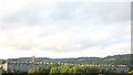
London Road Rooftops
Rooftops in London Road, seen from the Kennet & Avon canal towpath on a slightly grey evening. The tower of St Saviour's Church can be seen behind the houses.
Image: © David Roberts
Taken: 21 Aug 2009
0.07 miles
8
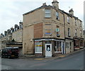
Writing on the wall of Larkhall Pharmacy, Bath
The pharmacy is in the SE corner of Larkhall Square.
A relic of a former occupier remains on the wall. The text is
COLEBY & GILES
BREAD, CORN AND
FLOUR FACTORS
Branch Depot
HEAD OFFICE
17 STALL STREET BATH
Image: © Jaggery
Taken: 24 Sep 2011
0.08 miles
9
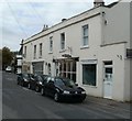
The Titfield Thunderbolt Bookshop, Bath
Located at 3A Upper Lambridge Street in the Larkhall ara of NE Bath,
The Titfield Thunderbolt is a specialist railway and transport bookshop.
Image: © Jaggery
Taken: 24 Sep 2011
0.08 miles
10
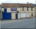
Larkhall MoT Centre, Bath
The business is in Beaufort Mews, near the corner of St Saviour's Road. One definition of "mews" is a street or yard of stabling, often converted into dwelling-houses or garages. The "street" and "garages" part of the description fit Beaufort Mews perfectly. http://www.geograph.org.uk/photo/3343295
Image: © Jaggery
Taken: 24 Sep 2011
0.08 miles