
IMAGES TAKEN NEAR TO
Fairfield Road, BATH, BA1 6JF
Introduction
This page details the photographs taken nearby to Fairfield Road, BA1 6JF by members of the Geograph project.
The Geograph project started in 2005 with the aim of publishing, organising and preserving representative images for every square kilometre of Great Britain, Ireland and the Isle of Man.

There are currently over 7.5m images from over14,400 individuals and you can help contribute to the project by visiting https://www.geograph.org.uk
Image Map
Images are licensed for reuse under creativecommons.org/licenses/by-sa/2.0
Notes
- Clicking on the map will re-center to the selected point.
- The higher the marker number, the further away the image location is from the centre of the postcode.
Image Listing (58 Images Found)
Images are licensed for reuse under creativecommons.org/licenses/by-sa/2.0
Image
Details
Distance
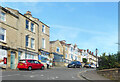
2
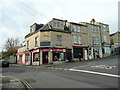
Claremont buildings, Bath
The ex-bakery and grocery is soon to be an ex-wine merchant.
This building is on the corner of Camden Road and Fairfield Road.
Image: © Jonathan Billinger
Taken: 25 Nov 2009
0.03 miles
3
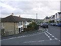
Looking SSE where Croft Rd meets Fairfield Rd
In the north-east of Bath at the junction of Croft Rd and Fairfield Rd, looking south-south-east.
Image: © Colin S Pearson
Taken: 25 Oct 2005
0.03 miles
4
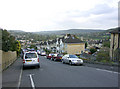
West end of Croft Road as it joins Fairfield Road
Looking east-north-east down Croft Road at its junction with Fairfield Road. The church beyond the roof on the right is St. Saviour's Church http://www.stsaviours.org.uk/ and is almost directly east of the camera.
Image: © Colin S Pearson
Taken: 25 Oct 2005
0.03 miles
5
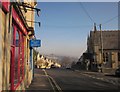
Junction, Camden, Bath
A crossroads with Claremont Church on the right, and an estate agents and off licence on the left. Ahead is the terrace shown in Image
Image: © Derek Harper
Taken: 11 Feb 2012
0.04 miles
6
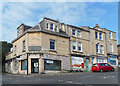
Ghost Sign on the Corner
An old painted sign for Claremont Bakery is still clearly visible on the corner face of an old shop at the end of Fairfield Road.
Currently occupied by Millies Care & Support Agency.
Image: © Des Blenkinsopp
Taken: 10 Sep 2020
0.04 miles
7
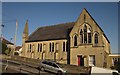
Claremont Methodist Church
Amalgamated in 2001 with Walcot Methodist Church to form Nexus. The steep road is Tyning Lane. The church can also be seen in Image
Image: © Derek Harper
Taken: 11 Feb 2012
0.04 miles
8
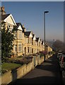
Eastbourne Avenue, Bath
Gabled terraced houses descend the hill from the junction with Fairfield Road.
Image: © Derek Harper
Taken: 11 Feb 2012
0.04 miles
9
Houses in Larkhall
With houses on Chilton Road, Southbourne Gardens and Eastbourne Avenue, seen from the Kennet and Avon Canal.
Image: © Derek Harper
Taken: 8 Dec 2019
0.05 miles
10
Croft Road, Bath
This steep residential road drops from Fairfield Road, with a view over Larkhall and the Lam Brook valley.
Image: © Derek Harper
Taken: 11 Feb 2012
0.06 miles