
IMAGES TAKEN NEAR TO
Sharpham, STREET, BA16 9SQ
Introduction
This page details the photographs taken nearby to BA16 9SQ by members of the Geograph project.
The Geograph project started in 2005 with the aim of publishing, organising and preserving representative images for every square kilometre of Great Britain, Ireland and the Isle of Man.

There are currently over 7.5m images from over14,400 individuals and you can help contribute to the project by visiting https://www.geograph.org.uk
Image Map
Images are licensed for reuse under creativecommons.org/licenses/by-sa/2.0
Notes
- Clicking on the map will re-center to the selected point.
- The higher the marker number, the further away the image location is from the centre of the postcode.
Image Listing (9 Images Found)
Images are licensed for reuse under creativecommons.org/licenses/by-sa/2.0
Image
Details
Distance
1
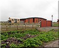
Modern timber building, Glastonbury Heath
Image: © Roger Cornfoot
Taken: 29 Mar 2017
0.01 miles
3
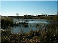
Flooded Peat Workings, Glastonbury Heath
Image: © Patrick Mackie
Taken: 18 Nov 2005
0.17 miles
5
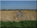
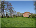
Reedbed in peat extraction site
Part of a large scale habitat recreation process on the Somerset Levels.
Image: © Hugh Venables
Taken: 8 Apr 2017
0.19 miles
6
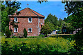
Sharpham : Fishpond Farm
Looking from the footpath across to Fishpond Farm.
Image: © Lewis Clarke
Taken: 18 May 2020
0.20 miles
7
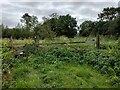
Gate and Stile near former Thurlbury Station
Image: © PAUL FARMER
Taken: 31 Aug 2021
0.24 miles
8
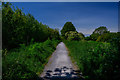
Sharpham : Footpath
Looking along the footpath.
Image: © Lewis Clarke
Taken: 18 May 2020
0.25 miles
9
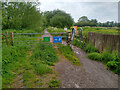
A Frame Barrier on Ham Wall RSPB Reserve
An A frame barrier at Ham Wall RSPB Reserve. This barrier is located at the eastern end of the reserve by Sharpham Drove.
The barrier is very restrictive with a width of just over 60cm.
The lock on the gate is not a RADAR lock, although the gate at the western end of the reserve does have a RADAR lock.
The trail through the reserve is a gravel track which is rutted, potholed, and uneven in places, and will be muddy and puddled in wet weather.
Image: © Kevin Pearson
Taken: 2 Jun 2021
0.25 miles