IMAGES TAKEN NEAR TO
High Street, STREET, BA16 0NE
Introduction
This page details the photographs taken nearby to High Street, BA16 0NE by members of the Geograph project.
The Geograph project started in 2005 with the aim of publishing, organising and preserving representative images for every square kilometre of Great Britain, Ireland and the Isle of Man.

There are currently over 7.5m images from over14,400 individuals and you can help contribute to the project by visiting https://www.geograph.org.uk
Image Map
Images are licensed for reuse under creativecommons.org/licenses/by-sa/2.0
Notes
- Clicking on the map will re-center to the selected point.
- The higher the marker number, the further away the image location is from the centre of the postcode.
Image Listing (90 Images Found)
Images are licensed for reuse under creativecommons.org/licenses/by-sa/2.0
Image
Details
Distance
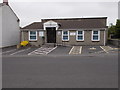
2
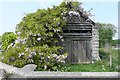
The wisteria wins
This garage is gradually succumbing to nature.
Image: © Graham Horn
Taken: 11 May 2008
0.05 miles
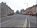
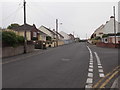
5
Highfield Road - viewed from Goswell Road
Image: © Betty Longbottom
Taken: 8 Jun 2016
0.07 miles
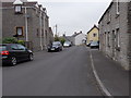
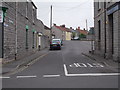
6
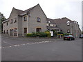
Arthur's Court Care Home - Goswell Road
Image: © Betty Longbottom
Taken: 8 Jun 2016
0.07 miles
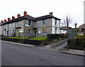
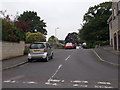
7
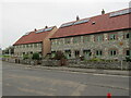
Street - High Street
Distinctive houses at the west end of the High Street in the factory town of Street, notable for Clark's shoes.
Image: © Colin Smith
Taken: 29 Mar 2022
0.08 miles