IMAGES TAKEN NEAR TO
High Street, STREET, BA16 0EJ
Introduction
This page details the photographs taken nearby to High Street, BA16 0EJ by members of the Geograph project.
The Geograph project started in 2005 with the aim of publishing, organising and preserving representative images for every square kilometre of Great Britain, Ireland and the Isle of Man.

There are currently over 7.5m images from over14,400 individuals and you can help contribute to the project by visiting https://www.geograph.org.uk
Image Map
Images are licensed for reuse under creativecommons.org/licenses/by-sa/2.0
Notes
- Clicking on the map will re-center to the selected point.
- The higher the marker number, the further away the image location is from the centre of the postcode.
Image Listing (355 Images Found)
Images are licensed for reuse under creativecommons.org/licenses/by-sa/2.0
Image
Details
Distance
2
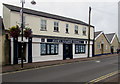
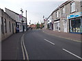
Jeanes Holland Burnell, Farm Road, Street, Somerset
Estate agents at 3 Farm Road.
Image: © Jaggery
Taken: 27 Sep 2016
0.01 miles
3
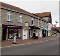
Crispin Crafts and Haberdashery, Street, Somerset
Craft shop at 8 Farm Road.
Image: © Jaggery
Taken: 27 Sep 2016
0.01 miles
4
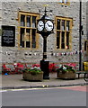
Public clock outside Crispin Hall, Street, Somerset
Located here. https://www.geograph.org.uk/photo/5854625
Image: © Jaggery
Taken: 27 Sep 2016
0.02 miles
5
![Street features [9]](https://s3.geograph.org.uk/geophotos/06/37/34/6373431_80644cd6_120x120.jpg)
Street features [9]
A fairly recent addition to the High Street is this clock outside Crispin Hall Image
The village of Street is situated at the end of the Polden Hills on a dry spot in the Somerset Levels. There is evidence of Roman settlement. In the mid 17th century, the Society of Friends was established in Street and one of the Quaker families who settled here were the Clarks. In 1825 James Clark began the production of slippers and later shoes and boots. The business flourished under his son, William, but profits were ploughed back into employee welfare, housing and education. Much of the housing in the centre of Street was built by the company.
Image: © Michael Dibb
Taken: 21 Sep 2019
0.02 miles
6
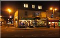
Shops in Street
The junction of the High Street with Farm Road, and with Christmas decorations.
Image: © Derek Harper
Taken: 22 Dec 2014
0.02 miles
7
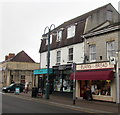
Burns the Bread in Street, Somerset
Bakery at 66 High Street.
Image: © Jaggery
Taken: 27 Sep 2016
0.02 miles
8
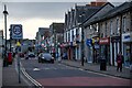
Street : High Street
Looking along Street High Street.
Image: © Lewis Clarke
Taken: 28 Jan 2024
0.02 miles
9
![Street buildings [11]](https://s2.geograph.org.uk/geophotos/06/37/34/6373426_d6b823a4_120x120.jpg)
Street buildings [11]
Crispin Hall occupies a prominent position in the High Street. Built in 1883 in the Domestic Revival style as a public hall, library and reading room, it is now a craft centre and hall. Listed, grade II, with details at: https://historicengland.org.uk/listing/the-list/list-entry/1345072
The village of Street is situated at the end of the Polden Hills on a dry spot in the Somerset Levels. There is evidence of Roman settlement. In the mid 17th century, the Society of Friends was established in Street and one of the Quaker families who settled here were the Clarks. In 1825 James Clark began the production of slippers and later shoes and boots. The business flourished under his son, William, but profits were ploughed back into employee welfare, housing and education. Much of the housing in the centre of Street was built by the company.
Image: © Michael Dibb
Taken: 21 Sep 2019
0.02 miles