
IMAGES TAKEN NEAR TO
Lansdown Road, BATH, BA1 5RE
Introduction
This page details the photographs taken nearby to Lansdown Road, BA1 5RE by members of the Geograph project.
The Geograph project started in 2005 with the aim of publishing, organising and preserving representative images for every square kilometre of Great Britain, Ireland and the Isle of Man.

There are currently over 7.5m images from over14,400 individuals and you can help contribute to the project by visiting https://www.geograph.org.uk
Image Map
Images are licensed for reuse under creativecommons.org/licenses/by-sa/2.0
Notes
- Clicking on the map will re-center to the selected point.
- The higher the marker number, the further away the image location is from the centre of the postcode.
Image Listing (38 Images Found)
Images are licensed for reuse under creativecommons.org/licenses/by-sa/2.0
Image
Details
Distance
1
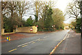
Lansdown Road
At the junction with Hamilton Road (left) and Charlcombe Lane (right).
Image: © Derek Harper
Taken: 8 Dec 2019
0.02 miles
2

Ordnance Survey Cut Mark
This OS cut mark can be found on the wall SE side of College Road. It marks a point 151.902m above mean sea level.
Image: © Adrian Dust
Taken: 25 May 2024
0.07 miles
3
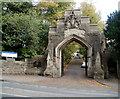
Ornate stone archway at the entrance to The Royal High School, Bath
Viewed across Lansdown Road from the corner of College Road.
Image: © Jaggery
Taken: 24 Sep 2011
0.07 miles
4
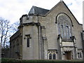
Kingswood School Chapel
The school was founded by John Wesley.
Image: © HelenK
Taken: 6 Nov 2010
0.08 miles
5
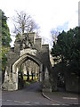
Entrance to the Royal High School
The Royal School, for the daughters of army officers, was originally on this site. In 1998 it merged with Bath High School to form the Royal High School. The main school building can be seen behind this elaborate gateway.
Image: © HelenK
Taken: 6 Nov 2010
0.08 miles
6
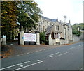
Senior School entrance, Kingswood School, Bath
Viewed across Lansdown Road.
Image: © Jaggery
Taken: 24 Sep 2011
0.11 miles
7
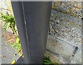
Ordnance Survey Cut Mark
This OS cut mark can be found on the wall NW side of Sion Road. It marks a point 145.387m above mean sea level.
Image: © Adrian Dust
Taken: 25 May 2024
0.12 miles
8
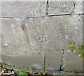
Ordnance Survey Cut Mark
This OS cut mark can be found on the wall at the junction of College Road & Waldegrove Road. It marks a point 145.344m above mean sea level.
Image: © Adrian Dust
Taken: 25 May 2024
0.12 miles
9
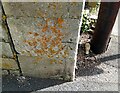
Ordnance Survey Cut Mark
This OS cut mark can be found on the wall at the junction of Lansdown Road & Northfields. It marks a point 148.820m above mean sea level.
Image: © Adrian Dust
Taken: 25 May 2024
0.12 miles
10
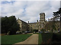
Kingswood School
The front of the main school building, with battlements to puzzle future archaeologists. Note the wooden sculpture of a squirrel under the tree on the left.
http://www.kingswood.bath.sch.uk/
Image: © HelenK
Taken: 6 Nov 2010
0.13 miles