
IMAGES TAKEN NEAR TO
Lansdown Place West, BATH, BA1 5EZ
Introduction
This page details the photographs taken nearby to Lansdown Place West, BA1 5EZ by members of the Geograph project.
The Geograph project started in 2005 with the aim of publishing, organising and preserving representative images for every square kilometre of Great Britain, Ireland and the Isle of Man.

There are currently over 7.5m images from over14,400 individuals and you can help contribute to the project by visiting https://www.geograph.org.uk
Image Map
Images are licensed for reuse under creativecommons.org/licenses/by-sa/2.0
Notes
- Clicking on the map will re-center to the selected point.
- The higher the marker number, the further away the image location is from the centre of the postcode.
Image Listing (109 Images Found)
Images are licensed for reuse under creativecommons.org/licenses/by-sa/2.0
Image
Details
Distance
1
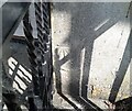
Ordnance Survey Cut Mark
This OS cut mark can be found on No3 Lansdown Place West. It marks a point 111.141m above mean sea level.
Image: © Adrian Dust
Taken: 25 May 2024
0.01 miles
2
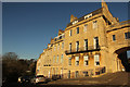
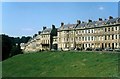
Lansdown Place West
Convex crescent of grade II listed houses west of the concave Lansdown Crescent http://www.geograph.org.uk/photo/5263033
Image: © Richard Croft
Taken: 20 Jan 2017
0.01 miles
3

Archway at Lansdown Crescent, Bath, 1966
Built between 1824 and 1830 for William Beckford as a link between the two buildings either side, which he had purchased separately, it is Listed Grade I separately from those two buildings. The colour wash on the facing stonework has since been removed https://www.geograph.org.uk/photo/4779259
Image: © Alan Murray-Rust
Taken: 18 Jul 1966
0.03 miles
4
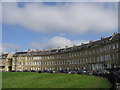
Lansdown Crescent
This crescent - sometimes used as a backdrop in adverts - is much less visited than the Royal Crescent. There are often sheep grazing on the lawn in front of it. 'The architectural treatment of Lansdown Crescent is less superb than the earlier, more formal, spaces in Bath... With its elevated position, its superb views over Bath, its fine overthrows and lamps and its patinated stonework, magical at dusk, the crescent has unrivalled presence.' (Michael Forsyth, Bath Pevsner Architectural Guide)
Image: © HelenK
Taken: 6 Jun 2007
0.03 miles
5
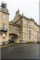
Archway, Lansdown Crescent
Archway connecting the terrace of Lansdown Place West and Lansdown Crescent, built in the 1820s for William Beckford to connect 1 Lansdown Place West (on the left) and 20 Lansdown Crescent (on the right) both of which he owned. Grade 1 listed - see http://www.historicengland.org.uk/listing/the-list/list-entry/1394110.
Image: © Ian Capper
Taken: 11 Dec 2015
0.03 miles
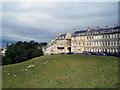
7
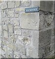
Ordnance Survey Cut Mark
This inverted & repositioned OS cut mark can be found on the wall angle west side of Upper Lansdown Mews. It marked a point 114.835m above mean sea level.
Image: © Adrian Dust
Taken: 25 May 2024
0.04 miles
8
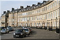
Lansdown Crescent
The crescent, which is a grade I listed building, comprises 20 houses. It was designed by John Palmer and constructed by a variety of builders between 1789 and 1793.
Image: © Rod Allday
Taken: 4 Mar 2013
0.04 miles
9
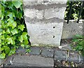
Ordnance Survey Cut Mark
This OS cut mark can be found on the post south side of Lansdown Place West. It marks a point 102.286m above mean sea level.
Image: © Adrian Dust
Taken: 25 May 2024
0.04 miles
10
Lansdown Crescent, Bath, 1966
Beyond the archway is Lansdown Place West. The houses either side of the archway were occupied by the eccentric William Beckford https://en.wikipedia.org/wiki/William_Beckford_(novelist) from around 1830. both terraces and the archway are Listed Grade I as separate listings.
By 2006 https://www.geograph.org.uk/photo/3826278 little had changed except the style of motor car.
Image: © Alan Murray-Rust
Taken: 18 Jul 1966
0.04 miles