IMAGES TAKEN NEAR TO
Beehive Yard, BATH, BA1 5BB

Introduction

This page details the photographs taken nearby to Beehive Yard, BA1 5BB by members of the Geograph project.

The Geograph project started in 2005 with the aim of publishing, organising and preserving representative images for every square kilometre of Great Britain, Ireland and the Isle of Man.

There are currently over 7.5m images from over14,400 individuals and you can help contribute to the project by visiting https://www.geograph.org.uk

Image Map


Images are licensed for reuse under creativecommons.org/licenses/by-sa/2.0
Notes
  • Clicking on the map will re-center to the selected point.
  • The higher the marker number, the further away the image location is from the centre of the postcode.

Image Listing (1256 Images Found)

Images are licensed for reuse under creativecommons.org/licenses/by-sa/2.0
  • ...
Image
Details
Distance
1
Former Bath Electric Tramways Depot, Walcot Street, Bath
By Harper & Harper, 1903, with engineers G. Hopkins & Sons. The trams stopped running in 1939, and this is now a bar and restaurant, the Tramshed.
Image: © Stephen Richards Taken: 25 May 2012
0.01 miles
2
The old tramshed
Now a furniture store, this was the old tram depot. Bath had a tram service running from 1880 to 1939.
Image: © Neil Owen Taken: 28 Dec 2021
0.02 miles
3
The Tramshed
Today it is a high quality restaurant, but it started life in the early 1900s to house the local carriages. When they stopped in 1939, the building became a garage before today's reincarnation. See Image] for a look at some of the white brickwork.
Image: © Neil Owen Taken: 7 Jan 2014
0.02 miles
4
Scaffolding and graffiti in Bath
On a long building in Walcot Street.
Image: © Jaggery Taken: 10 Dec 2012
0.02 miles
5
Glazed and standard
The Tramshed building was built with the side walls of white glazed bricks. See Image] for another view.
Image: © Neil Owen Taken: 7 Jan 2014
0.03 miles
6
Cornmarket, Bath
"1855. By GP Manners ... The size of the market building and its attached yard indicate the importance of Bath as an agricultural centre at this date, and of this part of the city as a long-established market area. Cotterell's 1852 plan of Bath shows there to have been a cattle market a short distance to the south" https://historicengland.org.uk/listing/the-list/list-entry/1395552 . The building is also shown under scaffolding seven years earlier at Image On the left is 62, Walcot Street https://historicengland.org.uk/listing/the-list/list-entry/1395551 , "remodelled to form entrance to corn market. c1770 with alterations of 1855 by GP Manners" Image . Behind the Cornmarket is The Tramshed Image
Image: © Derek Harper Taken: 8 Dec 2019
0.03 miles
7
Graffiti, Bath
Brightening a fence beside the cattle market. This is at the north side of the car park where the Saturday flea market was just setting up.
Image: © Derek Harper Taken: 11 Feb 2012
0.03 miles
8
Graffiti, Bath
A lilac bird also visible in Image Plans exist to transform this area with a casino and hotel. Sounds like a bit of a gamble to me.
Image: © Derek Harper Taken: 11 Feb 2012
0.03 miles
9
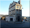
Former Corn Market, Bath
Located on the corner of Walcot Street and Beehive Yard, this is the western end of a 55 metre long building, built in 1855, extending to the west bank of the River Avon. Its size, and that of the adjacent yard, indicate the importance of Bath as an agricultural centre in the mid 19th century, and of this part of the city as a long-established market area. Cotterell's 1852 plan of Bath shows a cattle market nearby.
Image: © Jaggery Taken: 10 Dec 2012
0.03 miles
10
River Avon
Peaceful view of the river just a stone's throw from the busy city centre.
Image: © don cload Taken: 12 Sep 2010
0.03 miles
  • ...