
IMAGES TAKEN NEAR TO
Turleigh, BRADFORD-ON-AVON, BA15 2HF
Introduction
This page details the photographs taken nearby to BA15 2HF by members of the Geograph project.
The Geograph project started in 2005 with the aim of publishing, organising and preserving representative images for every square kilometre of Great Britain, Ireland and the Isle of Man.

There are currently over 7.5m images from over14,400 individuals and you can help contribute to the project by visiting https://www.geograph.org.uk
Image Map
Images are licensed for reuse under creativecommons.org/licenses/by-sa/2.0
Notes
- Clicking on the map will re-center to the selected point.
- The higher the marker number, the further away the image location is from the centre of the postcode.
Image Listing (44 Images Found)
Images are licensed for reuse under creativecommons.org/licenses/by-sa/2.0
Image
Details
Distance
1

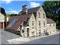
269 & 270 Turleigh
A pair of houses built circa 1700. Listed, grade II, with details at: https://www.historicengland.org.uk/listing/the-list/list-entry/1180973
Image: © Michael Dibb
Taken: 22 Jun 2018
0.01 miles

4

Thurleigh Cottage
Formerly known as Brooklands Lodge, this is a mid/late 18th century refronting of an earlier building. Listed, grade II, with details at: https://www.historicengland.org.uk/listing/the-list/list-entry/1021908
Image: © Michael Dibb
Taken: 22 Jun 2018
0.06 miles
5
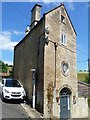
Wayside Coach House
Possibly best described as tall and thin.
Image: © Michael Dibb
Taken: 22 Jun 2018
0.07 miles
6

The Old Prince of Wales
The building operated as a public house from the 1860s until it closed in 1952.
Image: © Michael Dibb
Taken: 22 Jun 2018
0.08 miles
7
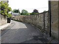
The bottom of Cottles Lane
Looking up the road from the junction with Turliegh Hill, a benchmark lies on the wall to the right. See Image] for a better view.
Image: © Neil Owen
Taken: 21 May 2024
0.08 miles
8
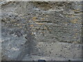
Benchmark at the end of Cottles Lane
A nineteenth century benchmark can be found near the junction with Turleigh Hill. See https://www.bench-marks.org.uk/bm170745 for the entry in the Benchmark Database and Image] for a wider view up the road.
Image: © Neil Owen
Taken: 21 May 2024
0.08 miles
9
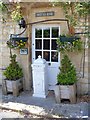
Witts End
The owners of this property were obviously at their wits end trying to decide where to put their letter box.
Image: © Michael Dibb
Taken: 22 Jun 2018
0.09 miles
10
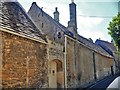
Turleigh House
The rear elevation of this house is uninteresting in stark contrast to the front. The house was previously called Brooklands and, in the early 20th century, Turleigh Mill because of the old tannery mill just below it. It is a long early 19th century two-storey building on an earlier core, under a mansard roof, with a canted bay on the garden side. Listed, grade II, with details at: https://www.historicengland.org.uk/listing/the-list/list-entry/1021909
Image: © Michael Dibb
Taken: 22 Jun 2018
0.09 miles