
IMAGES TAKEN NEAR TO
Mount Pleasant, BRADFORD-ON-AVON, BA15 1SJ
Introduction
This page details the photographs taken nearby to Mount Pleasant, BA15 1SJ by members of the Geograph project.
The Geograph project started in 2005 with the aim of publishing, organising and preserving representative images for every square kilometre of Great Britain, Ireland and the Isle of Man.

There are currently over 7.5m images from over14,400 individuals and you can help contribute to the project by visiting https://www.geograph.org.uk
Image Map
Images are licensed for reuse under creativecommons.org/licenses/by-sa/2.0
Notes
- Clicking on the map will re-center to the selected point.
- The higher the marker number, the further away the image location is from the centre of the postcode.
Image Listing (239 Images Found)
Images are licensed for reuse under creativecommons.org/licenses/by-sa/2.0
Image
Details
Distance
1
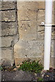
Benchmark on 'The Old School House'
Ordnance Survey cut mark benchmark described on the Bench Mark Database at http://www.bench-marks.org.uk/bm65513
Image: © Roger Templeman
Taken: 26 Mar 2015
0.02 miles
2

Mount Pleasant Community Centre
Bradford-on-Avon.
Image: © Ian S
Taken: 27 May 2016
0.02 miles
3
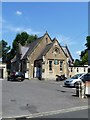
Social club
Part of the former school has become a social club.
Image: © Michael Dibb
Taken: 6 Jul 2018
0.02 miles
4
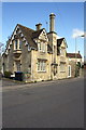
'The Old School House', Mount Pleasant
There is an OS benchmark Image on the road face of the house at the near corner (left of the white downpipe)
Image: © Roger Templeman
Taken: 26 Mar 2015
0.02 miles
5
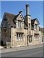
Former school house
Probably the headmasters house of the school. Grants were available for such houses after 1843. Built in 1847 in a Tudor Domestic Revival style at the same time as the school. The house is listed, grade II, with details at: https://www.historicengland.org.uk/listing/the-list/list-entry/1261943
Image: © Michael Dibb
Taken: 6 Jul 2018
0.02 miles
6
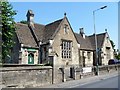
Former school
This former primary school is now a community centre. Built 1847 in Tudor Domestic Revival style and extended in 1911. The school closed circa 1980. Probably a National School given the proximity of the church. Listed, grade II, with details at: https://www.historicengland.org.uk/listing/the-list/list-entry/1253100
Image: © Michael Dibb
Taken: 6 Jul 2018
0.02 miles
7
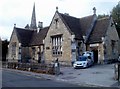
The Mount Pleasant Community Centre, Bradford-on-Avon
Located at 1A Mount Pleasant. The spire of Christ Church http://www.geograph.org.uk/photo/3443542 is in the background.
Image: © Jaggery
Taken: 7 Oct 2011
0.02 miles
8
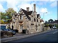
The Old School House, Mount Pleasant, Bradford-on-Avon
Built c1847 as a headmaster's house.
Image: © Jaggery
Taken: 7 Oct 2011
0.03 miles
9
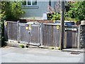
Sub station
A small electrical sub station at the top of Whitehill.
Image: © Michael Dibb
Taken: 6 Jul 2018
0.03 miles
10
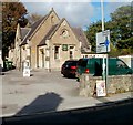
The Mount Pleasant Social Club, Bradford-on-Avon
Located alongside The Mount Pleasant Community Centre. http://www.geograph.org.uk/photo/3443658
Image: © Jaggery
Taken: 7 Oct 2011
0.03 miles