
IMAGES TAKEN NEAR TO
Frankland Close, BATH, BA1 4EJ
Introduction
This page details the photographs taken nearby to Frankland Close, BA1 4EJ by members of the Geograph project.
The Geograph project started in 2005 with the aim of publishing, organising and preserving representative images for every square kilometre of Great Britain, Ireland and the Isle of Man.

There are currently over 7.5m images from over14,400 individuals and you can help contribute to the project by visiting https://www.geograph.org.uk
Image Map
Images are licensed for reuse under creativecommons.org/licenses/by-sa/2.0
Notes
- Clicking on the map will re-center to the selected point.
- The higher the marker number, the further away the image location is from the centre of the postcode.
Image Listing (27 Images Found)
Images are licensed for reuse under creativecommons.org/licenses/by-sa/2.0
Image
Details
Distance
1
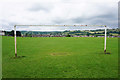
Recreation ground in Weston
The Cotswold Way passes over the corner of this recreation ground.
Image: © Bill Boaden
Taken: 21 Jul 2016
0.10 miles
2

The Cotswold Way towards Weston, Bath
The Cotswold Way, day five 1:09pm
Image: © Ian S
Taken: 21 Apr 2013
0.11 miles
3

Recreation ground
Recreation ground at Weston. The Cotswold Way crosses this field as it enters Weston near the southern end of this long distance footpath.
Image: © Philip Halling
Taken: 12 Jul 2021
0.12 miles
4
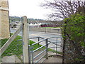
The Cotswold Way joins Penn Hill Road, Weston
The Cotswold Way, day five 1:12pm
Image: © Ian S
Taken: 21 Apr 2013
0.14 miles
5

The Cotswold Way towards Weston, Bath
The Cotswold Way, day five 1:07pm
Image: © Ian S
Taken: 21 Apr 2013
0.14 miles
7

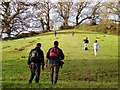
Walking the Cotswold Way
This is my wife, labouring up the first serious climb of the Cotswold Way (if you start in Bath) with a heavy backpack in the hot sun. It was just beginning to dawn on us by this point that neither of us was quite as fit as we had been the last time we went backpacking about ten years previously! Here, the path is climbing Penn Hill, which as every student of English place names knows, basically means "hill hill".
Image: © John Winder
Taken: 19 Jun 2017
0.16 miles
8

The Cotswold Way on Penn Hill Road
The Cotswold Way, day five 1:13pm
Image: © Ian S
Taken: 21 Apr 2013
0.17 miles
9
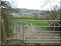
The Cotswold Way towards Weston, Bath
The Cotswold Way, day five 1:07pm
Image: © Ian S
Taken: 21 Apr 2013
0.19 miles
10

The Cotswold Way on Anchor Road, Weston
The Cotswold Way, day five 1:13pm
Image: © Ian S
Taken: 21 Apr 2013
0.20 miles