IMAGES TAKEN NEAR TO
St. James Gardens, TROWBRIDGE, BA14 8TH

Introduction

This page details the photographs taken nearby to St. James Gardens, BA14 8TH by members of the Geograph project.

The Geograph project started in 2005 with the aim of publishing, organising and preserving representative images for every square kilometre of Great Britain, Ireland and the Isle of Man.

There are currently over 7.5m images from over14,400 individuals and you can help contribute to the project by visiting https://www.geograph.org.uk

Image Map


Images are licensed for reuse under creativecommons.org/licenses/by-sa/2.0
Notes
  • Clicking on the map will re-center to the selected point.
  • The higher the marker number, the further away the image location is from the centre of the postcode.

Image Listing (256 Images Found)

Images are licensed for reuse under creativecommons.org/licenses/by-sa/2.0
  • ...
Image
Details
Distance
1
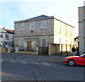
Grade II listed Zion Baptist Church, Trowbridge
Located on the corner of Union Street and Brewery Walk. The date stone beneath the central upper floor window shows ZION CHAPEL 1816. Grade II listed in December 1950.
Image: © Jaggery Taken: 5 Dec 2011
0.04 miles
2
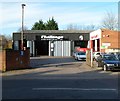
Challenge Ltd, Union Street, Trowbridge
Tyres, exhausts and MoT centre at 42-44 Union Street. On the right are the premises of Briken Motors, vehicle repairs and servicing.
Image: © Jaggery Taken: 5 Dec 2011
0.05 miles
3
Coleman & Starkey family dental practice, Trowbridge
Located in a converted house, Kenton, on Timbrell Street a few metres south of the Cross Street junction.
Image: © Jaggery Taken: 5 Dec 2011
0.05 miles
4
The old Sunday School
This rather older looking school actually dates from 1882, not Tudor times, attached as it was to the Tabernacle church beside it to the left. The architects were Paull and Bonella, with a William Smith the builder. To the right is the modern United Reformed Church. See Image] for more.
Image: © Neil Owen Taken: 26 Nov 2013
0.06 miles
5
Trowbridge buildings [11]
The first Tabernacle Congregational Church was built on this site in Church Street and opened in 1771. The existing building was built in 1882, a Tudor style aisled church with a tower. Constructed of ashlar under a slate roof. In 1972 the Congregational Union united with the Presbyterian Church to form the United Reformed Church. After closure in 2016, the church, adjoining Sunday school and the surrounding ancillary building were sold and are in the process of being converted into 29 dwellings. Listed, grade II, with details at: https://historicengland.org.uk/listing/the-list/list-entry/1284429 A market town and county town of Wiltshire, Trowbridge lies on the River Biss, 6 miles (10 kilometres) south of Bath. The town developed as a centre for woollen cloth production from the 14th century, which from the 17th century became increasingly industrialized, so much so that, in 1820, Trowbridge was described as the "Manchester of the West" with over 20 woollen cloth producing factories. The Kennet and Avon Canal runs just to the north of the town and both the Wessex Main Line (Bristol–Westbury–Southampton) and the Heart of Wessex Line (Bristol–Westbury–Weymouth) railways serve the station.
Image: © Michael Dibb Taken: 14 Feb 2023
0.06 miles
6
Church Street, looking east
Image: © Rob Purvis Taken: 9 Jul 2022
0.07 miles
7
Trowbridge houses [24]
Numbers 1 to 4 Union Street are almshouses. Built in 1861 in a Tudor vernacular style. Constructed of rubble stone and brick under a tile roof. The almshouses form a 'L' plan with numbers 18 and 19 Church Street (see Image). The main front has a covered porch loggia to the first and stone arches to the ground floor. Listed, grade II, with details at: https://historicengland.org.uk/listing/the-list/list-entry/1021663 A market town and county town of Wiltshire, Trowbridge lies on the River Biss, 6 miles (10 kilometres) south of Bath. The town developed as a centre for woollen cloth production from the 14th century, which from the 17th century became increasingly industrialized, so much so that, in 1820, Trowbridge was described as the "Manchester of the West" with over 20 woollen cloth producing factories. The Kennet and Avon Canal runs just to the north of the town and both the Wessex Main Line (Bristol–Westbury–Southampton) and the Heart of Wessex Line (Bristol–Westbury–Weymouth) railways serve the station.
Image: © Michael Dibb Taken: 14 Feb 2023
0.07 miles
8
Remains of Usher's Brewery - Back Street
Image: © Betty Longbottom Taken: 26 Aug 2008
0.08 miles
9
Top of the Tabernacle
Despite a number of mergers and reconstitutions over the years, the prominent round tower of the old church still stands proudly over the area. See Image] for more.
Image: © Neil Owen Taken: 26 Nov 2013
0.08 miles
10
Secluded row
Close to the main road but with plenty of greenery and some ornate stonework, these row of stone cottages retain a little peace. See Image] for more.
Image: © Neil Owen Taken: 26 Nov 2013
0.08 miles
  • ...