
IMAGES TAKEN NEAR TO
Lower Court, TROWBRIDGE, BA14 8QD
Introduction
This page details the photographs taken nearby to Lower Court, BA14 8QD by members of the Geograph project.
The Geograph project started in 2005 with the aim of publishing, organising and preserving representative images for every square kilometre of Great Britain, Ireland and the Isle of Man.

There are currently over 7.5m images from over14,400 individuals and you can help contribute to the project by visiting https://www.geograph.org.uk
Image Map
Images are licensed for reuse under creativecommons.org/licenses/by-sa/2.0
Notes
- Clicking on the map will re-center to the selected point.
- The higher the marker number, the further away the image location is from the centre of the postcode.
Image Listing (65 Images Found)
Images are licensed for reuse under creativecommons.org/licenses/by-sa/2.0
Image
Details
Distance
1
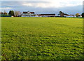
Trowbridge Cricket Club ground
Viewed from the Seymour Road side looking towards the pavilion.
Image: © Jaggery
Taken: 5 Dec 2011
0.02 miles
2
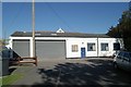
Trowbridge old fire station
Trowbridge old fire station, Lower Court, Trowbridge, Wiltshire
Image: © Kevin Hale
Taken: 5 Oct 2007
0.03 miles
3

2007 : Trowbridge Cricket Club
The Trowbridge cricket ground is conveniently situated near Trowbridge Hospital, though the entrance is in Lower Court at the north end of Timbrell Street http://www.trowbridge.cc/
Image: © Maurice Pullin
Taken: 15 Sep 2007
0.05 miles
4
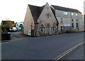
New Testament Church Of God, Trowbridge
Locate at 14 Islington, occupying a former Methodist chapel on the left and the adjoining building on the right.
Tracing its origins back to the American South in 1886 (a meeting house on the Tennessee-North Carolina border), the Church of God has grown to become one of the largest Pentecostal denominations, with a worldwide membership of more than 6 million and a presence in about 150 countries.
Image: © Jaggery
Taken: 5 Dec 2011
0.07 miles
5
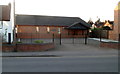
Kingdom Hall of Jehovah's Witnesses, Trowbridge
Located on the west side of a road named Islington, almost opposite the Delamere Road junction.
Jehovah's Witnesses use "Kingdom Hall" because the biblical use of "church" usually refers to the congregation of people rather than a structure.
Image: © Jaggery
Taken: 5 Dec 2011
0.07 miles
6
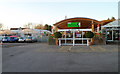
Entrance to Palmer Gardens, Trowbridge
Garden centre and cafe on the north side of a street named Islington.
Image: © Jaggery
Taken: 5 Dec 2011
0.07 miles
7

Prospect Place, Trowbridge
New housing.
Image: © M J Richardson
Taken: 24 Dec 2015
0.07 miles
8
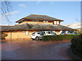
Adcroft Surgery, Trowbridge
On Prospect Place [B3106]
Image: © M J Richardson
Taken: 24 Dec 2015
0.07 miles
9

Grade II listed Palmers Almshouses, Trowbridge
The almshouses are at 42-44 Islington, on the corner of Palmer Road. Built in 1892 in the style of a 16th century manor house. Grade II listed in November 1976.
Located opposite The Old Toll house. http://www.geograph.org.uk/photo/2760010
Image: © Jaggery
Taken: 5 Dec 2011
0.08 miles
10
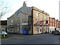
Grade II listed The Crown Hotel, Trowbridge
Located at 12 Timbrell Street. Originally an inn dating from the late 18th-early 19th century. There are five guest rooms. Grade II listed in December 1950.
This view taken in December 2011 shows a Freehold for Sale notice on the wall.
Image: © Jaggery
Taken: 5 Dec 2011
0.08 miles