
IMAGES TAKEN NEAR TO
Duke Street, TROWBRIDGE, BA14 8GB
Introduction
This page details the photographs taken nearby to Duke Street, BA14 8GB by members of the Geograph project.
The Geograph project started in 2005 with the aim of publishing, organising and preserving representative images for every square kilometre of Great Britain, Ireland and the Isle of Man.

There are currently over 7.5m images from over14,400 individuals and you can help contribute to the project by visiting https://www.geograph.org.uk
Image Map
Images are licensed for reuse under creativecommons.org/licenses/by-sa/2.0
Notes
- Clicking on the map will re-center to the selected point.
- The higher the marker number, the further away the image location is from the centre of the postcode.
Image Listing (265 Images Found)
Images are licensed for reuse under creativecommons.org/licenses/by-sa/2.0
Image
Details
Distance
1

Wiltshire Times office, Duke Street, Trowbridge
Offices of the Wiltshire Times at 15 Duke Street, photographed shortly after closure in 2019.
Image: © Steve Roberts
Taken: 5 May 2019
0.01 miles
2

Duke Street, Trowbridge
With a view towards St James' Church.
Image: © Derek Harper
Taken: 20 Jul 2011
0.02 miles
3
![Trowbridge buildings [8]](https://s3.geograph.org.uk/geophotos/07/43/74/7437431_3eb6a65c_120x120.jpg)
Trowbridge buildings [8]
The White Swan public house, number 6 Church Street, was built in the late 17th or early 18th century. Constructed of rubble stone, the front rendered, under a double Roman tile roof. The pub has closed since the date of this image. Listed, grade II, with details at: https://historicengland.org.uk/listing/the-list/list-entry/1182648
A market town and county town of Wiltshire, Trowbridge lies on the River Biss, 6 miles (10 kilometres) south of Bath. The town developed as a centre for woollen cloth production from the 14th century, which from the 17th century became increasingly industrialized, so much so that, in 1820, Trowbridge was described as the "Manchester of the West" with over 20 woollen cloth producing factories. The Kennet and Avon Canal runs just to the north of the town and both the Wessex Main Line (Bristol–Westbury–Southampton) and the Heart of Wessex Line (Bristol–Westbury–Weymouth) railways serve the station.
Image: © Michael Dibb
Taken: 14 Feb 2023
0.03 miles

5
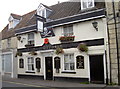
The White Swan
Take it as read - the pub is called the White Swan, despite the crossword-like incompletion. Interestingly enough, it is right next door to the Black Pearl, but appears to be able to offer some live music as an alternative. The skull and crossbones is actually a birthday greeting
Image: © Neil Owen
Taken: 24 Sep 2014
0.04 miles
6
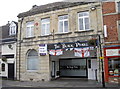
The Black Pearl
One of Trowbridge's more colourful pubs, it is currently in trouble. A licensing application has been rejected from a prospective landlord, taking over from the previous. However, after some concern over the conduct and reputation here the councillors have turned it down. The pub has been closed for about a month but the bills have not stopped - doubts hang over the place now.
Image: © Neil Owen
Taken: 24 Sep 2014
0.04 miles
7
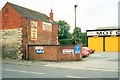
Duke Street, Trowbridge
I took this photo in 1998 and I believe this garage has since been demolished and new housing erected.
Image: © Roy Hughes
Taken: 15 Jun 2013
0.04 miles
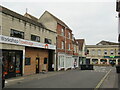
9
![Trowbridge buildings [9]](https://s1.geograph.org.uk/geophotos/07/43/74/7437437_dec28205_120x120.jpg)
Trowbridge buildings [9]
Number 9 Church Street was built in the 17th century and has been greatly altered. Set with a jettied gable end to the street. Partly timber framed, the rest partly built of rubble stone and partly built of brick. All under a double Roman tile roof. Listed, grade II, with details at: https://historicengland.org.uk/listing/the-list/list-entry/1021537
A market town and county town of Wiltshire, Trowbridge lies on the River Biss, 6 miles (10 kilometres) south of Bath. The town developed as a centre for woollen cloth production from the 14th century, which from the 17th century became increasingly industrialized, so much so that, in 1820, Trowbridge was described as the "Manchester of the West" with over 20 woollen cloth producing factories. The Kennet and Avon Canal runs just to the north of the town and both the Wessex Main Line (Bristol–Westbury–Southampton) and the Heart of Wessex Line (Bristol–Westbury–Weymouth) railways serve the station.
Image: © Michael Dibb
Taken: 14 Feb 2023
0.04 miles
10
![Trowbridge buildings [10]](https://s1.geograph.org.uk/geophotos/07/43/74/7437465_30efcccb_120x120.jpg)
Trowbridge buildings [10]
Set well back from the street is Emmanuel Baptist Church. The church was founded in 1736, renovated in 1902 and closed and renovated in 2010. Now used as an event space with various sizes of rooms available for hire. Constructed of ashlar with a Doric portico in antis, all under a slate roof. The interior has a gallery on all sides with curved corners. Listed, grade II, with details at: https://historicengland.org.uk/listing/the-list/list-entry/1021539
A market town and county town of Wiltshire, Trowbridge lies on the River Biss, 6 miles (10 kilometres) south of Bath. The town developed as a centre for woollen cloth production from the 14th century, which from the 17th century became increasingly industrialized, so much so that, in 1820, Trowbridge was described as the "Manchester of the West" with over 20 woollen cloth producing factories. The Kennet and Avon Canal runs just to the north of the town and both the Wessex Main Line (Bristol–Westbury–Southampton) and the Heart of Wessex Line (Bristol–Westbury–Weymouth) railways serve the station.
Image: © Michael Dibb
Taken: 14 Feb 2023
0.04 miles