
IMAGES TAKEN NEAR TO
St. Stephens Place, TROWBRIDGE, BA14 8AH
Introduction
This page details the photographs taken nearby to St. Stephens Place, BA14 8AH by members of the Geograph project.
The Geograph project started in 2005 with the aim of publishing, organising and preserving representative images for every square kilometre of Great Britain, Ireland and the Isle of Man.

There are currently over 7.5m images from over14,400 individuals and you can help contribute to the project by visiting https://www.geograph.org.uk
Image Map
Images are licensed for reuse under creativecommons.org/licenses/by-sa/2.0
Notes
- Clicking on the map will re-center to the selected point.
- The higher the marker number, the further away the image location is from the centre of the postcode.
Image Listing (268 Images Found)
Images are licensed for reuse under creativecommons.org/licenses/by-sa/2.0
Image
Details
Distance
1

Mill on the corner
At the junction of Mill Street and Court Street in the town centre in an area once a busy centre of textile production.
Image: © Des Blenkinsopp
Taken: 28 May 2026
0.05 miles
2
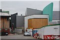
New building under construction, St Stephens Place
Image: © Oast House Archive
Taken: 24 Aug 2013
0.06 miles
3
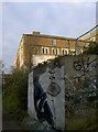
Prime location
The secluded riverside path provides plenty of opportunity for some urban expression. The deserted buildings in the background also lend a rather desolate flavour to the scene.
Image: © Neil Owen
Taken: 26 Nov 2013
0.07 miles
4

The mills of Court Street
There were several mills along the riverside here in Court Street - Brick Mills, Castle Mills and Castle Court Mills - all of which were involved with woollen goods. These days the fleeces are long gone and smaller units are available to various firms.
Image: © Neil Owen
Taken: 26 Nov 2013
0.07 miles
5
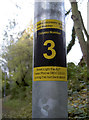
Every light has a number
It seems that Trowbridge has listed and accounted for all the street furniture - even if it is down a small footpath alongside the River Biss. Perhaps it is part of the never-ending round of council spending cuts that they rely on the public to report the problems?
See Image] for a wider view.
Image: © Neil Owen
Taken: 26 Nov 2013
0.07 miles
6
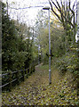
The path of leaves
The River Biss runs through Trowbridge and has a footpath to accompany it. See Image] for the notices on the lampposts.
Image: © Neil Owen
Taken: 26 Nov 2013
0.07 miles
7

Castle Factory, Court Street, Trowbridge
This block with the attic windows is from 1828. Originally a textile mill with steam power but in 1894 sold for furniture storage and showrooms. Still in commercial use. The section in the left foreground up to the end wall of the taller building has been demolished since this was taken and there is now a car park there.
Image: © Chris Allen
Taken: 8 Jan 2012
0.07 miles
8

Timber down!
A tree has finally come adrift from its tenuous grip on the far bank.
Image: © Neil Owen
Taken: 26 Nov 2013
0.07 miles
9
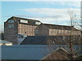
Castle Factory, Court street, Trowbridge
The block with the attic windows is from 1828 and the other block is from 1836. Originally a textile mill with steam power but in 1894 sold for furniture storage and showrooms. Still in commercial use.
Image: © Chris Allen
Taken: 8 Jan 2012
0.07 miles
10
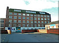
Castle Factory, Court Street, Trowbridge
This block with the attic windows is from 1828 and a block hidden behind it is from 1836. Originally a textile mill with steam power but in 1894 sold for furniture storage and showrooms. Still in commercial use. The lower section on the left has been demolished and replaced by a car park.
Image: © Chris Allen
Taken: 8 Jan 2012
0.07 miles