
IMAGES TAKEN NEAR TO
The Strand, TROWBRIDGE, BA14 6LJ
Introduction
This page details the photographs taken nearby to The Strand, BA14 6LJ by members of the Geograph project.
The Geograph project started in 2005 with the aim of publishing, organising and preserving representative images for every square kilometre of Great Britain, Ireland and the Isle of Man.

There are currently over 7.5m images from over14,400 individuals and you can help contribute to the project by visiting https://www.geograph.org.uk
Image Map
Images are licensed for reuse under creativecommons.org/licenses/by-sa/2.0
Notes
- Clicking on the map will re-center to the selected point.
- The higher the marker number, the further away the image location is from the centre of the postcode.
Image Listing (15 Images Found)
Images are licensed for reuse under creativecommons.org/licenses/by-sa/2.0
Image
Details
Distance
2
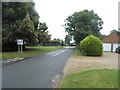
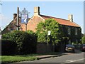
Main Street Great Hinton looking towards Trowbridge Road
Yes, it was raining.
Image: © David Howard
Taken: 21 Aug 2016
0.04 miles
4
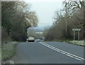
2009 : A361 looking west at The Strand
The lane to Great Hinton branches left here.
Semington is just over a mile ahead, then Hilperton then Trowbridge.
If you are following the A361 for the fun of it you have a long way to go.
Image: © Maurice Pullin
Taken: 1 Dec 2009
0.04 miles
5
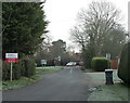
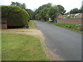
2009 : On the lane to Great Hinton
Looking back to The Strand and the A361.
Image: © Maurice Pullin
Taken: 1 Dec 2009
0.05 miles
6
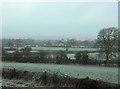
2009 : North from The Strand over frosty fields
Taken from the A361.
Mostly pasture land and a few farmhouses
Image: © Maurice Pullin
Taken: 1 Dec 2009
0.08 miles
7
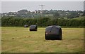
Recently cut field and hay bales
Some of the houses of Seend can be seen in the distance on the hillside.
Image: © Doug Lee
Taken: 7 Jun 2007
0.11 miles
8
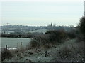
2009 : Frosty fields and a bridleway to Seend Head
After a bright start the sun hid itself for a few minutes.
The A361 passes a few yards to the right.
Image: © Maurice Pullin
Taken: 1 Dec 2009
0.12 miles
10
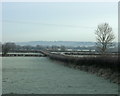
2009 : Frosty field seen from the A361
Looking north toward Bowerhill on the other side of the Kennet & Avon Canal.
The lane to Seend Park Farm is on the other side of the hedge.
Image: © Maurice Pullin
Taken: 1 Dec 2009
0.15 miles