IMAGES TAKEN NEAR TO
Littleton, TROWBRIDGE, BA14 6LG
Introduction
This page details the photographs taken nearby to Littleton, BA14 6LG by members of the Geograph project.
The Geograph project started in 2005 with the aim of publishing, organising and preserving representative images for every square kilometre of Great Britain, Ireland and the Isle of Man.

There are currently over 7.5m images from over14,400 individuals and you can help contribute to the project by visiting https://www.geograph.org.uk
Image Map
Images are licensed for reuse under creativecommons.org/licenses/by-sa/2.0
Notes
- Clicking on the map will re-center to the selected point.
- The higher the marker number, the further away the image location is from the centre of the postcode.
Image Listing (5 Images Found)
Images are licensed for reuse under creativecommons.org/licenses/by-sa/2.0
Image
Details
Distance
1
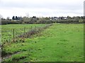
Fields near Great Hinton
Small fields beside the A361.
Image: © Maigheach-gheal
Taken: 3 Nov 2009
0.13 miles
2
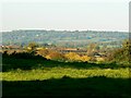
Field near Great Hinton
This is a view roughly north across the valley of the Semington Brook, a watercourse that runs west into the River Avon just east of Holt.
Image: © Brian Robert Marshall
Taken: 25 Oct 2010
0.15 miles
3
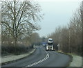
2009 : A361 looking west between Seend and Semington
The road is strangely quiet after 9am, had to wait over a minute for these two to arrive.
Image: © Maurice Pullin
Taken: 1 Dec 2009
0.16 miles
4
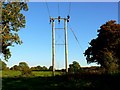
Electricity poles from the Great Hinton parish boundary
The power lines are seen as they lead away into the neighbouring Keevil Civil Parish.
Image: © Brian Robert Marshall
Taken: 25 Oct 2010
0.23 miles
5
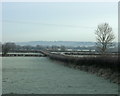
2009 : Frosty field seen from the A361
Looking north toward Bowerhill on the other side of the Kennet & Avon Canal.
The lane to Seend Park Farm is on the other side of the hedge.
Image: © Maurice Pullin
Taken: 1 Dec 2009
0.24 miles