
IMAGES TAKEN NEAR TO
Dark Lane South, TROWBRIDGE, BA14 6EZ
Introduction
This page details the photographs taken nearby to Dark Lane South, BA14 6EZ by members of the Geograph project.
The Geograph project started in 2005 with the aim of publishing, organising and preserving representative images for every square kilometre of Great Britain, Ireland and the Isle of Man.

There are currently over 7.5m images from over14,400 individuals and you can help contribute to the project by visiting https://www.geograph.org.uk
Image Map
Images are licensed for reuse under creativecommons.org/licenses/by-sa/2.0
Notes
- Clicking on the map will re-center to the selected point.
- The higher the marker number, the further away the image location is from the centre of the postcode.
Image Listing (241 Images Found)
Images are licensed for reuse under creativecommons.org/licenses/by-sa/2.0
Image
Details
Distance
1
![Steeple Ashton houses [13]](https://s0.geograph.org.uk/geophotos/07/43/38/7433848_a3fbef1f_120x120.jpg)
Steeple Ashton houses [13]
Quince Cottage, number 3 Dark Lane North, was built circa 1600 with a bay added in the late 17th century. Timber framed with square panels and brick nogging under a half-hipped Bridgwater tile roof. At the rear is a lean-to extension. Listed, grade II, with details at: https://historicengland.org.uk/listing/the-list/list-entry/1252402
The village of Steeple Ashton is a former market town, having been granted a weekly market in 1266. It lies some 3¼ miles east of Trowbridge and some 7 miles southwest of Devizes. The town became wealthy from its cloth industry, but there was a great fire in the early 16th century, and when it came to rebuilding the industry moved to the nearby town of Trowbridge, where the River Biss provided power for fulling mills. The first part of the village name comes from the former church spire, which collapsed in 1670.
Image: © Michael Dibb
Taken: 14 Feb 2023
0.06 miles
2
![Steeple Ashton houses [31]](https://s0.geograph.org.uk/geophotos/07/43/49/7434980_9d652e87_120x120.jpg)
Steeple Ashton houses [31]
The Old Firs, number 27 High Street, was originally a late 15th century open hall house with a cross wing. The wing is all that remains of the original building. The house was rebuilt in 1699 and there are 19th and 20th century additions. The 15th century part is timber framed with square panels, jettied to the street, with rendered infill, at the rear is the 17th century rebuild in dressed limestone, all under a stone slate roof. There is a 17th century service wing in rubble stone, altered in the 20th century. The 19th and 20th century additions are in brick with tile roofs. Many original internal features and fittings remain. There is another view of the house at Image Listed, grade II, with details at: https://historicengland.org.uk/listing/the-list/list-entry/1252608
The village of Steeple Ashton is a former market town, having been granted a weekly market in 1266. It lies some 3¼ miles east of Trowbridge and some 7 miles southwest of Devizes. The town became wealthy from its cloth industry, but there was a great fire in the early 16th century, and when it came to rebuilding the industry moved to the nearby town of Trowbridge, where the River Biss provided power for fulling mills. The first part of the village name comes from the former church spire, which collapsed in 1670.
Image: © Michael Dibb
Taken: 14 Feb 2023
0.06 miles
3
![Steeple Ashton houses [32]](https://s1.geograph.org.uk/geophotos/07/43/49/7434981_fd90c37a_120x120.jpg)
Steeple Ashton houses [32]
The Old Firs, number 27 High Street, was originally a late 15th century open hall house with a cross wing. The wing is all that remains of the original building. The house was rebuilt in 1699 and there are 19th and 20th century additions. The 15th century part is timber framed with square panels, jettied to the street, with rendered infill, at the rear is the 17th century rebuild in dressed limestone, all under a stone slate roof. There is a 17th century service wing in rubble stone, altered in the 20th century. The 19th and 20th century additions are in brick with tile roofs. Many original internal features and fittings remain. There is another view of the house at Image Listed, grade II, with details at: https://historicengland.org.uk/listing/the-list/list-entry/1252608
The village of Steeple Ashton is a former market town, having been granted a weekly market in 1266. It lies some 3¼ miles east of Trowbridge and some 7 miles southwest of Devizes. The town became wealthy from its cloth industry, but there was a great fire in the early 16th century, and when it came to rebuilding the industry moved to the nearby town of Trowbridge, where the River Biss provided power for fulling mills. The first part of the village name comes from the former church spire, which collapsed in 1670.
Image: © Michael Dibb
Taken: 14 Feb 2023
0.06 miles
4
![Steeple Ashton houses [33]](https://s3.geograph.org.uk/geophotos/07/43/49/7434983_c40b1315_120x120.jpg)
Steeple Ashton houses [33]
Lawn House, number 29 High Street, was built circa 1820. Constructed of brick with a limestone ashlar front, under a Welsh slate roof. There is a tent porch with decorative latticed sides. Listed, grade II, with details at: https://historicengland.org.uk/listing/the-list/list-entry/1252513
The village of Steeple Ashton is a former market town, having been granted a weekly market in 1266. It lies some 3¼ miles east of Trowbridge and some 7 miles southwest of Devizes. The town became wealthy from its cloth industry, but there was a great fire in the early 16th century, and when it came to rebuilding the industry moved to the nearby town of Trowbridge, where the River Biss provided power for fulling mills. The first part of the village name comes from the former church spire, which collapsed in 1670.
Image: © Michael Dibb
Taken: 14 Feb 2023
0.06 miles
5
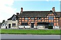
Steeple Ashton: c16th Old Merchants Hall
Image: © Michael Garlick
Taken: 30 Sep 2021
0.07 miles
6
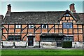
Steeple Ashton: c16th Old Merchants Hall
Image: © Michael Garlick
Taken: 30 Sep 2021
0.07 miles
7

Steeple Ashton, c16th Old Merchants Hall: Entrance
Image: © Michael Garlick
Taken: 30 Sep 2021
0.07 miles
8
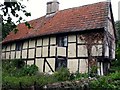
The Sanctuary, Steeple Ashton
Late medieval cruck house in Dark Lane North
Image: © Paul Taylor
Taken: 6 Jul 2004
0.07 miles
9
![Steeple Ashton houses [16]](https://s3.geograph.org.uk/geophotos/07/43/38/7433855_b14b11df_120x120.jpg)
Steeple Ashton houses [16]
Cruck Cottage, number 11 Dark Lane North, is a 15th century detached cottage, gable end to the street, altered in the late 16th century and re-roofed in the 1970s following a fire. Timber framed with square panels on full cruck trusses, with rendered infill under a Welsh slate roof. Some early internal features and fittings remain. Listed, grade II, with details at: https://historicengland.org.uk/listing/the-list/list-entry/1252505
The village of Steeple Ashton is a former market town, having been granted a weekly market in 1266. It lies some 3¼ miles east of Trowbridge and some 7 miles southwest of Devizes. The town became wealthy from its cloth industry, but there was a great fire in the early 16th century, and when it came to rebuilding the industry moved to the nearby town of Trowbridge, where the River Biss provided power for fulling mills. The first part of the village name comes from the former church spire, which collapsed in 1670.
Image: © Michael Dibb
Taken: 14 Feb 2023
0.08 miles
10
![Steeple Ashton houses [44]](https://s2.geograph.org.uk/geophotos/07/43/66/7436650_f1e76e3d_120x120.jpg)
Steeple Ashton houses [44]
Number 54 High Street is semi-detached with number 50 Image Built in the 15th century and altered in the early 19th century. Timber framed, partly rebuilt in brick on a dressed limestone plinth under a stone slate roof. The house is set with the jettied gable end to the street and is probably the cross wing of a hall house, the hall probably was on the site of Number 50 which was rebuilt in the early 17th century. Many original internal features and fittings remain. Listed, grade II, with details at: https://historicengland.org.uk/listing/the-list/list-entry/1252687
The village of Steeple Ashton is a former market town, having been granted a weekly market in 1266. It lies some 3¼ miles east of Trowbridge and some 7 miles southwest of Devizes. The town became wealthy from its cloth industry, but there was a great fire in the early 16th century, and when it came to rebuilding the industry moved to the nearby town of Trowbridge, where the River Biss provided power for fulling mills. The first part of the village name comes from the former church spire, which collapsed in 1670.
Image: © Michael Dibb
Taken: 14 Feb 2023
0.08 miles