Steeple Ashton houses [44]
Introduction
The photograph on this page of Steeple Ashton houses [44] by Michael Dibb as part of the Geograph project.
The Geograph project started in 2005 with the aim of publishing, organising and preserving representative images for every square kilometre of Great Britain, Ireland and the Isle of Man.

There are currently over 7.5m images from over 14,400 individuals and you can help contribute to the project by visiting https://www.geograph.org.uk
Steeple Ashton houses [44]
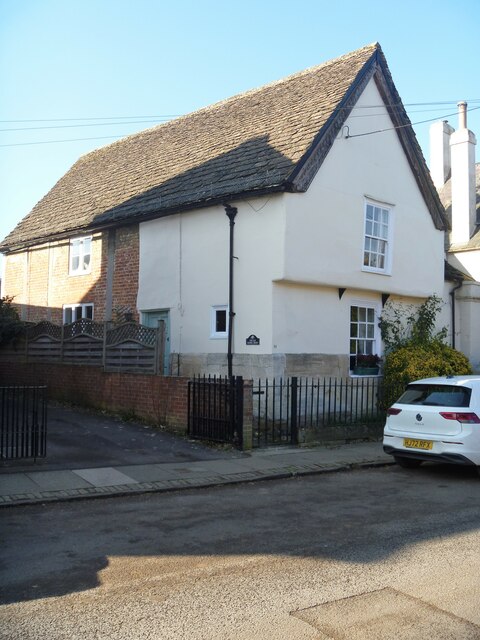
Image: © Michael Dibb Taken: 14 Feb 2023
Number 54 High Street is semi-detached with number 50 Image Built in the 15th century and altered in the early 19th century. Timber framed, partly rebuilt in brick on a dressed limestone plinth under a stone slate roof. The house is set with the jettied gable end to the street and is probably the cross wing of a hall house, the hall probably was on the site of Number 50 which was rebuilt in the early 17th century. Many original internal features and fittings remain. Listed, grade II, with details at: https://historicengland.org.uk/listing/the-list/list-entry/1252687 The village of Steeple Ashton is a former market town, having been granted a weekly market in 1266. It lies some 3¼ miles east of Trowbridge and some 7 miles southwest of Devizes. The town became wealthy from its cloth industry, but there was a great fire in the early 16th century, and when it came to rebuilding the industry moved to the nearby town of Trowbridge, where the River Biss provided power for fulling mills. The first part of the village name comes from the former church spire, which collapsed in 1670.
Images are licensed for reuse under creativecommons.org/licenses/by-sa/2.0
Image Location
Latitude
51.309545
Longitude
-2.134649