
IMAGES TAKEN NEAR TO
Bratton Road, WESTBURY, BA13 4TG
Introduction
This page details the photographs taken nearby to Bratton Road, BA13 4TG by members of the Geograph project.
The Geograph project started in 2005 with the aim of publishing, organising and preserving representative images for every square kilometre of Great Britain, Ireland and the Isle of Man.

There are currently over 7.5m images from over14,400 individuals and you can help contribute to the project by visiting https://www.geograph.org.uk
Image Map
Images are licensed for reuse under creativecommons.org/licenses/by-sa/2.0
Notes
- Clicking on the map will re-center to the selected point.
- The higher the marker number, the further away the image location is from the centre of the postcode.
Image Listing (32 Images Found)
Images are licensed for reuse under creativecommons.org/licenses/by-sa/2.0
Image
Details
Distance
1
![A circular walk from Bratton [79]](https://s2.geograph.org.uk/geophotos/06/48/25/6482514_e75607de_120x120.jpg)
A circular walk from Bratton [79]
Fair View House alongside the B3098 road has been much improved in recent years.
The walk leaves Bratton heading northwest then turns west, circling around the former cement factory to the Old Coach Road on the edge of Westbury. The return is past the Westbury White Horse viewing site on a bridleway and then a track, Lower Westbury Road. About 5¾ miles.
Image: © Michael Dibb
Taken: 21 Apr 2020
0.02 miles
2
![A circular walk from Bratton [80]](https://s0.geograph.org.uk/geophotos/06/48/25/6482516_bb497794_120x120.jpg)
A circular walk from Bratton [80]
An unusual octagonal stone pillar at the side of the B3098.
The walk leaves Bratton heading northwest then turns west, circling around the former cement factory to the Old Coach Road on the edge of Westbury. The return is past the Westbury White Horse viewing site on a bridleway and then a track, Lower Westbury Road. About 5¾ miles.
Image: © Michael Dibb
Taken: 21 Apr 2020
0.02 miles
3
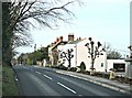
2008 : Bratton Road, Westbury
Coming into Westbury on the B3098 Bratton Road these are the first houses we see.
Behind us is a good view of the Westbury White Horse shown elsewhere in this grid square.
Image: © Maurice Pullin
Taken: 25 Jan 2008
0.03 miles
4

2008 : Fair View Farm
Farm buildings belonging to the aptly named Fair View Farm on the Bratton Road out of Westbury.
Image: © Maurice Pullin
Taken: 25 Jan 2008
0.05 miles
5
Welcome to Westbury, sign on B3098
An unusual welcome sign, with the town name in gold/orange
Image: © David Smith
Taken: 1 Jun 2017
0.09 miles
6
![A circular walk from Bratton [78]](https://s2.geograph.org.uk/geophotos/06/48/25/6482510_20f3e1ca_120x120.jpg)
A circular walk from Bratton [78]
The path known as Donkey Lane continues as a public bridleway on the far side of Bratton Road, B3098.
The walk leaves Bratton heading northwest then turns west, circling around the former cement factory to the Old Coach Road on the edge of Westbury. The return is past the Westbury White Horse viewing site on a bridleway and then a track, Lower Westbury Road. About 5¾ miles.
Image: © Michael Dibb
Taken: 21 Apr 2020
0.10 miles
7

The White Horse glimpsed from Westbury Cemetery
Also see https://en.wikipedia.org/wiki/Westbury_White_Horse
Image: © Basher Eyre
Taken: 22 Aug 2016
0.11 miles

9
![A circular walk from Bratton [81]](https://s0.geograph.org.uk/geophotos/06/48/25/6482524_c9a613e6_120x120.jpg)
A circular walk from Bratton [81]
From Bratton Road, B3098, a track, Lower Westbury Road, also a public bridleway, forks to the left. The track, later a surfaced road, runs nearly two miles to Trowbridge Road in Bratton.
The walk leaves Bratton heading northwest then turns west, circling around the former cement factory to the Old Coach Road on the edge of Westbury. The return is past the Westbury White Horse viewing site on a bridleway and then a track, Lower Westbury Road. About 5¾ miles.
Image: © Michael Dibb
Taken: 21 Apr 2020
0.12 miles
10
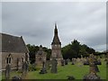
Westbury Cemetery: impressive memorial
Image: © Basher Eyre
Taken: 22 Aug 2016
0.14 miles