
IMAGES TAKEN NEAR TO
Westbury Road, WESTBURY, BA13 4TD
Introduction
This page details the photographs taken nearby to Westbury Road, BA13 4TD by members of the Geograph project.
The Geograph project started in 2005 with the aim of publishing, organising and preserving representative images for every square kilometre of Great Britain, Ireland and the Isle of Man.

There are currently over 7.5m images from over14,400 individuals and you can help contribute to the project by visiting https://www.geograph.org.uk
Image Map
Images are licensed for reuse under creativecommons.org/licenses/by-sa/2.0
Notes
- Clicking on the map will re-center to the selected point.
- The higher the marker number, the further away the image location is from the centre of the postcode.
Image Listing (85 Images Found)
Images are licensed for reuse under creativecommons.org/licenses/by-sa/2.0
Image
Details
Distance
1
![A walk from Edington to the Plain and return [67]](https://s2.geograph.org.uk/geophotos/06/49/46/6494650_a96ddb33_120x120.jpg)
A walk from Edington to the Plain and return [67]
At the junction of the tracks there are not only three ways to go but some fine views. This is looking west along the escarpment over the village of Bratton towards the former cement factory which is seen in the centre of the image.
From the priory church in Edington the walk leaves the village by way of Salisbury Hollow, a byway, and ascends Coulston Hill. The route joins the long distance White Horse Trail to pass over Tinhead Hill on a byway to Tenantry Down. Then an ascent of Edington Hill on a footpath before dropping steeply down Picquet Hill on another footpath to return to the start via Sandy Lane.
Image: © Michael Dibb
Taken: 24 Apr 2020
0.02 miles


4
![Bratton ways [12]](https://s2.geograph.org.uk/geophotos/06/48/74/6487470_2768ab31_120x120.jpg)
Bratton ways [12]
From Upper Garston Lane this footpath runs parallel to and above Combe Lane towards Westbury Road.
Bratton is a former agricultural village which lies on the ‘springline’ of the northern escarpment of Salisbury Plain about 2½ miles east of the town of Westbury. Large flocks of sheep were pastured on the Downs south of the village and corn was grown on the flat lands to the north. The village was the home of the renowned firm of R & J Reeves who produced agricultural machinery.
Image: © Michael Dibb
Taken: 21 Apr 2020
0.10 miles

6
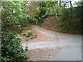
Junction of Combe Lane and Upper Garston Lane, Bratton
Image: © Penny Mayes
Taken: 17 Oct 2015
0.12 miles
7
![Bratton houses [28]](https://s3.geograph.org.uk/geophotos/06/48/86/6488635_a5cb88ce_120x120.jpg)
Bratton houses [28]
This property in Bury Street was originally one mid 17th century house. Divided into two semi-detached cottages in the early 18th century with a mid 18th century rear extension. Now restored to one house. Listed, grade II, with details at: https://historicengland.org.uk/listing/the-list/list-entry/1036506
Bratton is a former agricultural village which lies on the ‘springline’ of the northern escarpment of Salisbury Plain about 2½ miles east of the town of Westbury. Large flocks of sheep were pastured on the Downs south of the village and corn was grown on the flat lands to the north. The village was the home of the renowned firm of R & J Reeves who produced agricultural machinery.
Image: © Michael Dibb
Taken: 21 Apr 2020
0.12 miles
8
![Bratton houses [29]](https://s0.geograph.org.uk/geophotos/06/48/86/6488636_48febedf_120x120.jpg)
Bratton houses [29]
The delightful Court Lane Farmhouse, now a detached house is a former farmhouse. Built in the mid 17th century, timber framed with a thatched roof. The extension to the left is late 18th century and the eves of the 17th century range were raised in brick under an 18th century roof. Listed, grade II, with details at: https://historicengland.org.uk/listing/the-list/list-entry/1036514
Bratton is a former agricultural village which lies on the ‘springline’ of the northern escarpment of Salisbury Plain about 2½ miles east of the town of Westbury. Large flocks of sheep were pastured on the Downs south of the village and corn was grown on the flat lands to the north. The village was the home of the renowned firm of R & J Reeves who produced agricultural machinery.
Image: © Michael Dibb
Taken: 21 Apr 2020
0.13 miles
9
![Bratton ways [13]](https://s0.geograph.org.uk/geophotos/06/48/74/6487472_0c10253a_120x120.jpg)
Bratton ways [13]
From Upper Garston Lane this footpath crosses the combe to the church of St James and beyond to Longcombe Bottom and Combe Hill.
Bratton is a former agricultural village which lies on the ‘springline’ of the northern escarpment of Salisbury Plain about 2½ miles east of the town of Westbury. Large flocks of sheep were pastured on the Downs south of the village and corn was grown on the flat lands to the north. The village was the home of the renowned firm of R & J Reeves who produced agricultural machinery.
Image: © Michael Dibb
Taken: 21 Apr 2020
0.13 miles
10
![Bratton houses [27]](https://s3.geograph.org.uk/geophotos/06/48/86/6488627_615c2714_120x120.jpg)
Bratton houses [27]
Ballards is a late 18th century rebuilding in brick of an earlier house. The left front has a mezzanine floor. Listed, grade II, with details at: https://historicengland.org.uk/listing/the-list/list-entry/1364306
Bratton is a former agricultural village which lies on the ‘springline’ of the northern escarpment of Salisbury Plain about 2½ miles east of the town of Westbury. Large flocks of sheep were pastured on the Downs south of the village and corn was grown on the flat lands to the north. The village was the home of the renowned firm of R & J Reeves who produced agricultural machinery.
Image: © Michael Dibb
Taken: 21 Apr 2020
0.14 miles