
IMAGES TAKEN NEAR TO
Coombe Lane, WESTBURY, BA13 4SY
Introduction
This page details the photographs taken nearby to Coombe Lane, BA13 4SY by members of the Geograph project.
The Geograph project started in 2005 with the aim of publishing, organising and preserving representative images for every square kilometre of Great Britain, Ireland and the Isle of Man.

There are currently over 7.5m images from over14,400 individuals and you can help contribute to the project by visiting https://www.geograph.org.uk
Image Map
Images are licensed for reuse under creativecommons.org/licenses/by-sa/2.0
Notes
- Clicking on the map will re-center to the selected point.
- The higher the marker number, the further away the image location is from the centre of the postcode.
Image Listing (105 Images Found)
Images are licensed for reuse under creativecommons.org/licenses/by-sa/2.0
Image
Details
Distance
1
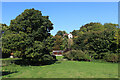
Near Combe Lane
Looking towards Combe Lane from Combe Hill.
Image: © Wayland Smith
Taken: 14 Sep 2020
0.03 miles
2

Looking up Church Steps, Bratton
On the north side of the combe.
Image: © Penny Mayes
Taken: 17 Oct 2015
0.05 miles
3
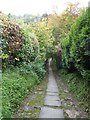
Looking down Church Steps from the north side of the combe, Bratton
Image: © Penny Mayes
Taken: 17 Oct 2015
0.05 miles
4
![Bratton ways [10]](https://s3.geograph.org.uk/geophotos/06/48/74/6487467_54658d4a_120x120.jpg)
Bratton ways [10]
Laid in stone steps, the footpath descends from the church to the bottom of the combe then rises to meet Upper Garston Lane.
Bratton is a former agricultural village which lies on the ‘springline’ of the northern escarpment of Salisbury Plain about 2½ miles east of the town of Westbury. Large flocks of sheep were pastured on the Downs south of the village and corn was grown on the flat lands to the north. The village was the home of the renowned firm of R & J Reeves who produced agricultural machinery.
Image: © Michael Dibb
Taken: 21 Apr 2020
0.05 miles
5
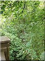
Salcombe Water, Bratton
A small stream runs through the bottom of the combe from a pool fed by Church Springs. It is very hard to see when there are leaves on the trees (as is the pool) but this was my attempt from the bridge at the bottom of the combe.
Image: © Penny Mayes
Taken: 17 Oct 2015
0.05 miles
6

Church Steps, Bratton
From the bridge at the bottom of the combe looking up towards the church.
Image: © Penny Mayes
Taken: 17 Oct 2015
0.06 miles
7
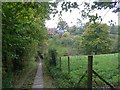
From the top of Church Steps, St James the Great, Bratton
Church Steps is a stepped, cobbled footpath which connects the church with the village the other side of the combe.
Image] in the background and Image] below it.
Image: © Penny Mayes
Taken: 16 Oct 2015
0.06 miles

9

2010 : Valley below Bratton Church
A local story has it that when the clock in Bratton Church strikes midnight the Westbury White Horse walks down to Bridewell Spring for a drink. (There is no clock in Bratton Church.)
Image: © Maurice Pullin
Taken: 21 Feb 2010
0.07 miles
10
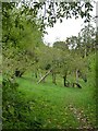
Reeves Orchard, Bratton
From Church Steps.
On the north side of the combe is a community orchard containing several varieties of apple trees, many of which are marked by the name of the variety, the name of who planted it and the date of planting, the earliest dates I noticed were in the 1930s.
The land was owned by the Reeves family who ran the ironworks and foundry in Bratton. The allotments on the upper slope are made on the bases of the hothouses that supplied the family with out of season fruits and vegetables. The pump house and pumps that drew water from the stream to supply the hothouses, are situated in the orchard but are not open to the public.
In 1936 a mixed orchard of 146 trees was planted. There are a number of different varieties of apples, including: Green Bramley, Ellisons Orange, Laxton's Superb, Newton Wonder, Scarlet Bramley, Charles Ross, Peacemaker, Cox's Orange Pippin, James Grieve and Heron Pippin, and several varieties of Damson trees.
The orchard was gifted to the village in 1988, and lay dormant and heavily overgrown for some years prior to the Parish Council's Conservation Management Plan in 1998.
More details of their planned management of the area here http://web.archive.org/web/20150504205740/http://www.brattonvillage.co.uk/localhistory-Reeves_Community_Orchard_Project_Bratton.htm
See also Image
Image: © Penny Mayes
Taken: 17 Oct 2015
0.07 miles