IMAGES TAKEN NEAR TO
Southay, WESTBURY, BA13 4RT
Introduction
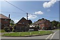
This page details the photographs taken nearby to Southay, BA13 4RT by members of the Geograph project.
The Geograph project started in 2005 with the aim of publishing, organising and preserving representative images for every square kilometre of Great Britain, Ireland and the Isle of Man.

There are currently over 7.5m images from over14,400 individuals and you can help contribute to the project by visiting https://www.geograph.org.uk
Image Map
Images are licensed for reuse under creativecommons.org/licenses/by-sa/2.0
Notes
- Clicking on the map will re-center to the selected point.
- The higher the marker number, the further away the image location is from the centre of the postcode.
Image Listing (144 Images Found)
Images are licensed for reuse under creativecommons.org/licenses/by-sa/2.0
Image
Details
Distance
1
![Bratton ways [6]](https://s3.geograph.org.uk/geophotos/06/48/61/6486103_15318afe_120x120.jpg)
Bratton ways [6]
From near the junction of Stradbrook, Imber Road and Church Road, this path, The Ball, runs to Emm's Lane.
Bratton is a former agricultural village which lies on the ‘springline’ of the northern escarpment of Salisbury Plain about 2½ miles east of the town of Westbury. Large flocks of sheep were pastured on the Downs south of the village and corn was grown on the flat lands to the north. The village was the home of the renowned firm of R & J Reeves who produced agricultural machinery.
Image: © Michael Dibb
Taken: 21 Apr 2020
0.05 miles
2
![Bratton ways [7]](https://s2.geograph.org.uk/geophotos/06/48/61/6486114_2f392f3b_120x120.jpg)
Bratton ways [7]
Drivers are advised to ignore their satnav systems and not enter Millditch which soon becomes little more than a footpath.
Bratton is a former agricultural village which lies on the ‘springline’ of the northern escarpment of Salisbury Plain about 2½ miles east of the town of Westbury. Large flocks of sheep were pastured on the Downs south of the village and corn was grown on the flat lands to the north. The village was the home of the renowned firm of R & J Reeves who produced agricultural machinery.
Image: © Michael Dibb
Taken: 21 Apr 2020
0.05 miles
3
![Bratton features [3]](https://s0.geograph.org.uk/geophotos/06/48/61/6486144_80618d95_120x120.jpg)
Bratton features [3]
More whimsy alongside the stream in Church Road.
Bratton is a former agricultural village which lies on the ‘springline’ of the northern escarpment of Salisbury Plain about 2½ miles east of the town of Westbury. Large flocks of sheep were pastured on the Downs south of the village and corn was grown on the flat lands to the north. The village was the home of the renowned firm of R & J Reeves who produced agricultural machinery.
Image: © Michael Dibb
Taken: 21 Apr 2020
0.07 miles
4
![Bratton features [1]](https://s0.geograph.org.uk/geophotos/06/48/61/6486128_8dce18b2_120x120.jpg)
Bratton features [1]
A plank bridge over the stream. The sign on the stile advises 'Private land. No Right of Way. Access for childrens games ONLY.'
Bratton is a former agricultural village which lies on the ‘springline’ of the northern escarpment of Salisbury Plain about 2½ miles east of the town of Westbury. Large flocks of sheep were pastured on the Downs south of the village and corn was grown on the flat lands to the north. The village was the home of the renowned firm of R & J Reeves who produced agricultural machinery.
Image: © Michael Dibb
Taken: 21 Apr 2020
0.07 miles
5
![Bratton features [2]](https://s2.geograph.org.uk/geophotos/06/48/61/6486142_6990e421_120x120.jpg)
Bratton features [2]
Some mobiles have been built in the steam which flows alongside Church Road.
Bratton is a former agricultural village which lies on the ‘springline’ of the northern escarpment of Salisbury Plain about 2½ miles east of the town of Westbury. Large flocks of sheep were pastured on the Downs south of the village and corn was grown on the flat lands to the north. The village was the home of the renowned firm of R & J Reeves who produced agricultural machinery.
Image: © Michael Dibb
Taken: 21 Apr 2020
0.07 miles
6
![Bratton ways [8]](https://s0.geograph.org.uk/geophotos/06/48/61/6486152_518f5137_120x120.jpg)
Bratton ways [8]
The track leaving Church Road is a public bridleway leading to Longcombe Bottom and then up to meet the Imber Range Perimeter Path on the edge of Salisbury Plain.
Bratton is a former agricultural village which lies on the ‘springline’ of the northern escarpment of Salisbury Plain about 2½ miles east of the town of Westbury. Large flocks of sheep were pastured on the Downs south of the village and corn was grown on the flat lands to the north. The village was the home of the renowned firm of R & J Reeves who produced agricultural machinery.
Image: © Michael Dibb
Taken: 21 Apr 2020
0.09 miles
7
![Bratton houses [20]](https://s3.geograph.org.uk/geophotos/06/48/74/6487479_854cdc89_120x120.jpg)
Bratton houses [20]
This fine detached house is named The Butts and is located in the road of the same name. Built circa 1830 in brick with a 20th century rear extension. Listed, grade II, with details at: https://historicengland.org.uk/listing/the-list/list-entry/1364307
Bratton is a former agricultural village which lies on the ‘springline’ of the northern escarpment of Salisbury Plain about 2½ miles east of the town of Westbury. Large flocks of sheep were pastured on the Downs south of the village and corn was grown on the flat lands to the north. The village was the home of the renowned firm of R & J Reeves who produced agricultural machinery.
Image: © Michael Dibb
Taken: 21 Apr 2020
0.11 miles
8
![Bratton buildings [1]](https://s3.geograph.org.uk/geophotos/06/48/74/6487483_2a837ced_120x120.jpg)
Bratton buildings [1]
The Church Institute Hall in Tynings Lane is one of three buildings (the others are the Jubilee Hall and The Pavilion) in the village available for community and group use as well as for private hire.
Bratton is a former agricultural village which lies on the ‘springline’ of the northern escarpment of Salisbury Plain about 2½ miles east of the town of Westbury. Large flocks of sheep were pastured on the Downs south of the village and corn was grown on the flat lands to the north. The village was the home of the renowned firm of R & J Reeves who produced agricultural machinery.
Image: © Michael Dibb
Taken: 21 Apr 2020
0.11 miles
9
![Bratton houses [19]](https://s1.geograph.org.uk/geophotos/06/48/74/6487477_ce8b7b72_120x120.jpg)
Bratton houses [19]
The Coach House in the road named The Butts is probably the coach house to the house named The Butts.
Bratton is a former agricultural village which lies on the ‘springline’ of the northern escarpment of Salisbury Plain about 2½ miles east of the town of Westbury. Large flocks of sheep were pastured on the Downs south of the village and corn was grown on the flat lands to the north. The village was the home of the renowned firm of R & J Reeves who produced agricultural machinery.
Image: © Michael Dibb
Taken: 21 Apr 2020
0.11 miles