
IMAGES TAKEN NEAR TO
Salisbury Hollow, WESTBURY, BA13 4PF
Introduction
This page details the photographs taken nearby to Salisbury Hollow, BA13 4PF by members of the Geograph project.
The Geograph project started in 2005 with the aim of publishing, organising and preserving representative images for every square kilometre of Great Britain, Ireland and the Isle of Man.

There are currently over 7.5m images from over14,400 individuals and you can help contribute to the project by visiting https://www.geograph.org.uk
Image Map
Images are licensed for reuse under creativecommons.org/licenses/by-sa/2.0
Notes
- Clicking on the map will re-center to the selected point.
- The higher the marker number, the further away the image location is from the centre of the postcode.
Image Listing (43 Images Found)
Images are licensed for reuse under creativecommons.org/licenses/by-sa/2.0
Image
Details
Distance
2
![Edington buildings [3]](https://s3.geograph.org.uk/geophotos/06/49/60/6496035_015f7c9f_120x120.jpg)
Edington buildings [3]
Now converted into 2 private houses, this former Methodist chapel was originally built in 1828. The chapel was enlarged in 1948 and a Sunday school started the following year. The chapel was largely rebuilt in 1904. It closed in 2006.
Edington is a former agricultural village which lies on the ‘springline’ of the northern escarpment of Salisbury Plain about 4 miles east of the town of Westbury. A priory was founded in the 14th century and became a monastery of the Brothers of Penitence, or Bonshommes. The magnificent monastery church continues in use as the parish church and is the home of the nationally-known annual Edington Music Festival.
Image: © Michael Dibb
Taken: 24 Apr 2020
0.02 miles
3

2010 : B3098 at Edington
Looking east.
The next turning on the right is Long Hollow.
Image: © Maurice Pullin
Taken: 5 Mar 2010
0.03 miles
4
![A walk from Edington to the Plain and return [4]](https://s1.geograph.org.uk/geophotos/06/48/97/6489785_43f34526_120x120.jpg)
A walk from Edington to the Plain and return [4]
After crossing Westbury Road, B3098, the route runs up Salisbury Hollow.
From the priory church in Edington the walk leaves the village by way of Salisbury Hollow, a byway, and ascends Coulston Hill. The route joins the long distance White Horse Trail to pass over Tinhead Hill on a byway to Tenantry Down. Then an ascent of Edington Hill on a footpath before dropping steeply down Picquet Hill on another footpath to return to the start via Sandy Lane.
Image: © Michael Dibb
Taken: 24 Apr 2020
0.03 miles
5
![Edington houses [7]](https://s3.geograph.org.uk/geophotos/06/49/59/6495907_a39ee6c2_120x120.jpg)
Edington houses [7]
Number 3 Salisbury Hollow is an 18th century thatched detached cottage in rubblestone. The rear of the cottage retains the main posts from the former timber-framing. Listed, grade II, with details at: https://historicengland.org.uk/listing/the-list/list-entry/1181348
Edington is a former agricultural village which lies on the ‘springline’ of the northern escarpment of Salisbury Plain about 4 miles east of the town of Westbury. A priory was founded in the 14th century and became a monastery of the Brothers of Penitence, or Bonshommes. The magnificent monastery church continues in use as the parish church and is the home of the nationally-known annual Edington Music Festival.
Image: © Michael Dibb
Taken: 24 Apr 2020
0.03 miles
6
![Edington features [5]](https://s0.geograph.org.uk/geophotos/06/49/59/6495900_02782576_120x120.jpg)
Edington features [5]
The milestone seen here on the B3098 road at its junction with Long Hollow has been moved from a position further east. The plate showing London 97 miles is a recent addition. The stone is seen in context at Image
Edington is a former agricultural village which lies on the ‘springline’ of the northern escarpment of Salisbury Plain about 4 miles east of the town of Westbury. A priory was founded in the 14th century and became a monastery of the Brothers of Penitence, or Bonshommes. The magnificent monastery church continues in use as the parish church and is the home of the nationally-known annual Edington Music Festival.
Image: © Michael Dibb
Taken: 24 Apr 2020
0.04 miles
7
![Edington features [4]](https://s3.geograph.org.uk/geophotos/06/49/58/6495895_73be40f3_120x120.jpg)
Edington features [4]
The milestone seen here on the B3098 road at its junction with Long Hollow has been moved from a position further east. The plate showing London 97 miles is a recent addition. A closer view is at Image
Edington is a former agricultural village which lies on the ‘springline’ of the northern escarpment of Salisbury Plain about 4 miles east of the town of Westbury. A priory was founded in the 14th century and became a monastery of the Brothers of Penitence, or Bonshommes. The magnificent monastery church continues in use as the parish church and is the home of the nationally-known annual Edington Music Festival.
Image: © Michael Dibb
Taken: 24 Apr 2020
0.04 miles
8
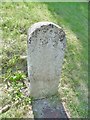
Old Milestone by the B3098, Westbury Road, Edington
Carved stone post by the B3098, in parish of Edington (West Wiltshire District), Westbury Road, Edington, junction with Long Hollow on embankment, on South-west side of road. Erected by the Westbury Turnpike Trust in the 19th century. The stone's original location is recorded further east at ST 9354 5337
Inscription is illegible.
The stone did have an Ordnance Survey cut mark but this is now lost.
Milestone Society National ID: WI_ZEDING.
Image: © Milestone Society
Taken: 25 Jul 2017
0.04 miles
9
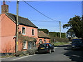
2010 : B3098 Westbury Road at Edington
Heading east toward Erlestoke and Littleton Panell.
Image: © Maurice Pullin
Taken: 5 Mar 2010
0.04 miles
10
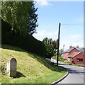
Milestone in the centre of Edington
A close up is in Image
Image: © David Smith
Taken: 1 Jun 2017
0.05 miles