IMAGES TAKEN NEAR TO
Capps Lane, WESTBURY, BA13 4NE
Introduction
This page details the photographs taken nearby to Capps Lane, BA13 4NE by members of the Geograph project.
The Geograph project started in 2005 with the aim of publishing, organising and preserving representative images for every square kilometre of Great Britain, Ireland and the Isle of Man.

There are currently over 7.5m images from over14,400 individuals and you can help contribute to the project by visiting https://www.geograph.org.uk
Image Map
Images are licensed for reuse under creativecommons.org/licenses/by-sa/2.0
Notes
- Clicking on the map will re-center to the selected point.
- The higher the marker number, the further away the image location is from the centre of the postcode.
Image Listing (23 Images Found)
Images are licensed for reuse under creativecommons.org/licenses/by-sa/2.0
Image
Details
Distance
1
![A circular walk from Bratton [35]](https://s1.geograph.org.uk/geophotos/06/47/91/6479173_97ee4103_120x120.jpg)
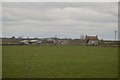
A circular walk from Bratton [35]
Seen from the footpath is Horse Croft Farmhouse. The main part of the house is mid 18th century, the rear wing is dated 1863. Some original internal features remain. Listed, grade II, with details at: https://historicengland.org.uk/listing/the-list/list-entry/1036504
The walk leaves Bratton heading northwest then turns west, circling around the former cement factory to the Old Coach Road on the edge of Westbury. The return is past the Westbury White Horse viewing site on a bridleway and then a track, Lower Westbury Road. About 5¾ miles.
Image: © Michael Dibb
Taken: 21 Apr 2020
0.01 miles
2
![A circular walk from Bratton [34]](https://s3.geograph.org.uk/geophotos/06/47/80/6478083_e4fb78d1_120x120.jpg)
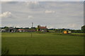
A circular walk from Bratton [34]
The footpath continues towards Horse Croft Farm. In the distance can be seen some of the storage silos of the former cement factory. The site was reduced to serving as a distribution depot in 2009. Until 2016 there was a 400 foot high chimney on the site.
The walk leaves Bratton heading northwest then turns west, circling around the former cement factory to the Old Coach Road on the edge of Westbury. The return is past the Westbury White Horse viewing site on a bridleway and then a track, Lower Westbury Road. About 5¾ miles.
Image: © Michael Dibb
Taken: 21 Apr 2020
0.03 miles
3
![A circular walk from Bratton [36]](https://s2.geograph.org.uk/geophotos/06/47/91/6479174_d21750bc_120x120.jpg)
A circular walk from Bratton [36]
Some of the farm buildings at Horse Croft Farm. Seen from the footpath.
The walk leaves Bratton heading northwest then turns west, circling around the former cement factory to the Old Coach Road on the edge of Westbury. The return is past the Westbury White Horse viewing site on a bridleway and then a track, Lower Westbury Road. About 5¾ miles.
Image: © Michael Dibb
Taken: 21 Apr 2020
0.03 miles
5
![A circular walk from Bratton [33]](https://s3.geograph.org.uk/geophotos/06/47/80/6478075_587d7d88_120x120.jpg)
A circular walk from Bratton [33]
This somewhat overgrown stile takes the footpath into the next field.
The walk leaves Bratton heading northwest then turns west, circling around the former cement factory to the Old Coach Road on the edge of Westbury. The return is past the Westbury White Horse viewing site on a bridleway and then a track, Lower Westbury Road. About 5¾ miles.
Image: © Michael Dibb
Taken: 21 Apr 2020
0.08 miles
9
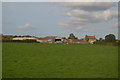
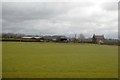
View towards Horse Croft Farm
The discolouration of the grass can be seen on aerial photographs of the area. Possibly a buried pipe?
Image: © N Chadwick
Taken: 29 Mar 2015
0.10 miles