IMAGES TAKEN NEAR TO
Storridge Road, WESTBURY, BA13 4HY
Introduction
This page details the photographs taken nearby to Storridge Road, BA13 4HY by members of the Geograph project.
The Geograph project started in 2005 with the aim of publishing, organising and preserving representative images for every square kilometre of Great Britain, Ireland and the Isle of Man.

There are currently over 7.5m images from over14,400 individuals and you can help contribute to the project by visiting https://www.geograph.org.uk
Image Map
Images are licensed for reuse under creativecommons.org/licenses/by-sa/2.0
Notes
- Clicking on the map will re-center to the selected point.
- The higher the marker number, the further away the image location is from the centre of the postcode.
Image Listing (4 Images Found)
Images are licensed for reuse under creativecommons.org/licenses/by-sa/2.0
Image
Details
Distance
1

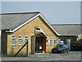
2008 : Storridge Farm
This once proud farm standing on the banks of the Biss Brook now seems to be given over to the manufacture of concrete blocks and other artifacts.
They have a ready supply of cement and aggregate nearby.
Image: © Maurice Pullin
Taken: 9 Jun 2008
0.04 miles
2
2008 : Sir, I would have preferred it on the forecourt
A return to the days when traders advertised their calling by hanging a sample of their wares outside the premises.
On a trading estate near Westbury, Wilts
Image: © Maurice Pullin
Taken: 9 Jun 2008
0.08 miles
3
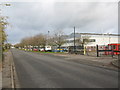
Quartermaster Road, West Wilts. Trading Estate
Looking east along Quartermaster Road on the West Wilts. Trading Estate. The large building is a distribution warehouse for COMET.
Image: © Phil Williams
Taken: 26 Nov 2005
0.18 miles
4

Northacre Industrial Park, Westbury
Looking west across the roundabout at the entrance to the Northacre Industrial Park, Westbury.
Image: © Phil Williams
Taken: 26 Nov 2005
0.21 miles